Area Overview for SG18 9DJ
Photos of SG18 9DJ


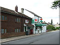
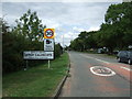
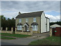
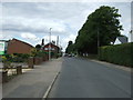
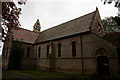
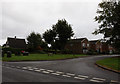
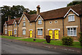
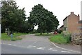
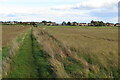
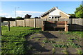
26 photos from this area
Area Information
Key information about the SG18 9DJ including its size, population, and administrative classification.
- Area Type
- Postcode
- Area Size
- 2.3 hectares
- Population
- 1652
- Population Density
- 188 people/km²
House Prices in SG18 9DJ
22
Properties
£225,241
Average Sold Price
£80,000
Lowest Price
£410,000
Highest Price
Showing 22 properties
| Address | Type | Beds | Baths | Last Sale Price | Last Sale Date | |
|---|---|---|---|---|---|---|
| 20 Ashby Drive, Upper Caldecote, SG18 9DJ | Detached | 4 | 1 | £410,000 | Mar 2025 | |
| 12 Ashby Drive, Upper Caldecote, SG18 9DJ | Detached | 3 | 2 | £352,000 | Sep 2020 | |
| 17 Ashby Drive, Upper Caldecote, SG18 9DJ | house | 4 | 1 | £244,000 | Jan 2013 | |
| 18 Ashby Drive, Upper Caldecote, SG18 9DJ | house | 4 | - | £249,000 | Sep 2012 | |
| 15 Ashby Drive, Upper Caldecote, SG18 9DJ | house | 4 | - | £236,000 | Jan 2012 | |
| 4 Ashby Drive, Upper Caldecote, SG18 9DJ | Detached | - | - | £320,000 | Oct 2007 | |
| 26 Ashby Drive, Upper Caldecote, SG18 9DJ | house | - | - | £339,950 | Apr 2006 | |
| 16 Ashby Drive, Upper Caldecote, SG18 9DJ | Detached | - | - | £219,950 | Sep 2002 | |
| 9 Ashby Drive, Upper Caldecote, SG18 9DJ | Detached | - | - | £213,000 | Aug 2002 | |
| 19 Ashby Drive, Upper Caldecote, SG18 9DJ | Detached | - | - | £185,000 | May 2002 |
Page 1 of 3
Energy Efficiency in SG18 9DJ
Amenities
Schools
| Rank | School | Type | Entry gender | Ages |
|---|
Explore more schools in this area
Go to Schools tabDemographics
Household Size
Two person
most common
Accommodation Type
Houses
most common
Tenure
80
majority
Ethnic Group
White
most common
Religion
N/A
most common
Household Composition
N/A
most common
Age
47
median
Adults (30-64 years)
most common
Household Deprivation
N/A
with no deprivation
NS-SEC
39
in Lower managerial occupations
Explore more demographic insights in this area
Go to Demographics tabPlanning
Planning Constraints
- Flood RiskPremium
- Ramsar Wetland SitesPremium
- Area of Outstanding Natural BeautyPremium
- Protected Nature ReservePremium
- Protected WoodlandPremium