Area Overview for SG18 9AQ
Photos of SG18 9AQ
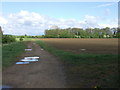
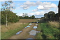
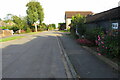
3 photos from this area
Area Information
Key information about the SG18 9AQ including its size, population, and administrative classification.
- Area Type
- Postcode
- Area Size
- 10.1 hectares
- Population
- 1409
- Population Density
- 95 people/km²
House Prices in SG18 9AQ
33
Properties
£331,167
Average Sold Price
£22,500
Lowest Price
£957,500
Highest Price
Showing 33 properties
| Address | Type | Beds | Baths | Last Sale Price | Last Sale Date | |
|---|---|---|---|---|---|---|
| Cow Hovel Road, 7 Thorncote Road, Northill, SG18 9AQ | house | 2 | 2 | £385,000 | Jun 2024 | |
| 14 Thorncote Road, Northill, SG18 9AQ | Detached | 3 | 2 | £675,000 | Oct 2023 | |
| The Old Brewhouse, Thorncote Road, Northill, SG18 9AQ | house | - | - | £957,500 | Nov 2022 | |
| 6 Thorncote Road, Northill, SG18 9AQ | Terraced | 3 | 1 | £320,000 | Sep 2021 | |
| 5 Thorncote Road, Northill, SG18 9AQ | Terraced | 3 | 1 | £275,000 | Sep 2020 | |
| 4 Thorncote Road, Northill, SG18 9AQ | Terraced | 4 | 2 | £400,000 | Aug 2020 | |
| 2 Thorncote Road, Northill, SG18 9AQ | Detached | 4 | - | £450,000 | Jun 2017 | |
| Pax Cottage, 8 Thorncote Road, Northill, SG18 9AQ | Terraced | 3 | 1 | £225,000 | May 2014 | |
| 13 Thorncote Road, Northill, SG18 9AQ | Retail | 2 | 2 | £310,000 | Aug 2012 | |
| 24 Thorncote Road, Northill, SG18 9AQ | Detached | - | - | £495,000 | Aug 2007 |
Page 1 of 4
Energy Efficiency in SG18 9AQ
Amenities
Schools
| Rank | School | Type | Entry gender | Ages |
|---|
Explore more schools in this area
Go to Schools tabDemographics
Household Size
Two person
most common
Accommodation Type
Houses
most common
Tenure
81
majority
Ethnic Group
White
most common
Religion
N/A
most common
Household Composition
N/A
most common
Age
47
median
Adults (30-64 years)
most common
Household Deprivation
N/A
with no deprivation
NS-SEC
39
in Lower managerial occupations
Explore more demographic insights in this area
Go to Demographics tabPlanning
Planning Constraints
- Flood RiskPremium
- Ramsar Wetland SitesPremium
- Area of Outstanding Natural BeautyPremium
- Protected Nature ReservePremium
- Protected WoodlandPremium