Area Overview for SG18 8XY
Photos of SG18 8XY
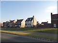
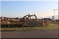
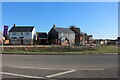
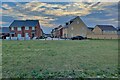
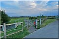
18 photos from this area
Area Information
Key information about the SG18 8XY including its size, population, and administrative classification.
- Area Type
- Postcode
- Area Size
- 3.4 hectares
- Population
- 1408
- Population Density
- 2391 people/km²
House Prices in SG18 8XY
46
Properties
£286,231
Average Sold Price
£183,000
Lowest Price
£535,000
Highest Price
Showing 46 properties
| Address | Type | Beds | Baths | Last Sale Price | Last Sale Date | |
|---|---|---|---|---|---|---|
| 86 Tavener Drive, Biggleswade, SG18 8XY | Detached | 2 | 2 | £250,000 | Oct 2025 | |
| 102 Tavener Drive, Biggleswade, SG18 8XY | Flat | 1 | 1 | £200,000 | Aug 2025 | |
| 95 Tavener Drive, Biggleswade, SG18 8XY | Flat | 2 | 2 | £240,000 | Aug 2025 | |
| 96 Tavener Drive, Biggleswade, SG18 8XY | Flat | - | - | £200,000 | Jul 2025 | |
| 94 Tavener Drive, Biggleswade, SG18 8XY | Flat | 2 | 2 | £245,000 | Mar 2025 | |
| 104 Tavener Drive, Biggleswade, SG18 8XY | Flat | - | - | £237,500 | Feb 2025 | |
| 62 Tavener Drive, Biggleswade, SG18 8XY | Detached | 2 | 2 | £270,000 | Nov 2024 | |
| 97 Tavener Drive, Biggleswade, SG18 8XY | Flat | - | - | £254,000 | Jul 2024 | |
| 60 Tavener Drive, Biggleswade, SG18 8XY | Terraced | 2 | 2 | £295,000 | Feb 2024 | |
| 70 Tavener Drive, Biggleswade, SG18 8XY | Terraced | 2 | 2 | £310,000 | Jul 2023 |
Page 1 of 5
Energy Efficiency in SG18 8XY
Amenities
Schools
| Rank | School | Type | Entry gender | Ages |
|---|
Explore more schools in this area
Go to Schools tabDemographics
Household Size
Family (3-5 people)
most common
Accommodation Type
Houses
most common
Tenure
85
majority
Ethnic Group
White
most common
Religion
N/A
most common
Household Composition
N/A
most common
Age
47
median
Adults (30-64 years)
most common
Household Deprivation
N/A
with no deprivation
NS-SEC
52
in Lower managerial occupations
Explore more demographic insights in this area
Go to Demographics tabPlanning
Planning Constraints
- Flood RiskPremium
- Ramsar Wetland SitesPremium
- Area of Outstanding Natural BeautyPremium
- Protected Nature ReservePremium
- Protected WoodlandPremium