Area Overview for SG18 8LJ
Photos of SG18 8LJ

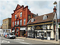
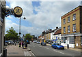
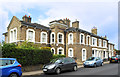
59 photos from this area
Area Information
Key information about the SG18 8LJ including its size, population, and administrative classification.
- Area Type
- Postcode
- Area Size
- 7536 m²
- Population
- 1937
- Population Density
- 5700 people/km²
House Prices in SG18 8LJ
18
Properties
£200,314
Average Sold Price
£30,000
Lowest Price
£355,000
Highest Price
Showing 18 properties
| Address | Type | Beds | Baths | Last Sale Price | Last Sale Date | |
|---|---|---|---|---|---|---|
| 43 Dells Lane, Biggleswade, SG18 8LJ | house | - | - | £318,000 | Aug 2023 | |
| 47 Dells Lane, Biggleswade, SG18 8LJ | house | 3 | 1 | £355,000 | Mar 2023 | |
| 29 Dells Lane, Biggleswade, SG18 8LJ | house | - | - | £245,000 | Nov 2019 | |
| 39 Dells Lane, Biggleswade, SG18 8LJ | Semi-detached | 3 | 1 | £215,000 | Oct 2018 | |
| 31 Dells Lane, Biggleswade, SG18 8LJ | Semi-detached | - | - | £137,500 | Sep 2018 | |
| 53 Dells Lane, Biggleswade, SG18 8LJ | Detached | 5 | - | £274,000 | Jul 2013 | |
| 27 Dells Lane, Biggleswade, SG18 8LJ | house | 3 | - | £209,000 | Jan 2012 | |
| 51 Dells Lane, Biggleswade, SG18 8LJ | Detached | - | - | £223,000 | Nov 2001 | |
| 23 Dells Lane, Biggleswade, SG18 8LJ | Semi-detached | 2 | - | £30,000 | Aug 2000 | |
| 25 Dells Lane, Biggleswade, SG18 8LJ | Semi-detached | - | - | £59,950 | Oct 1997 |
Page 1 of 2
Energy Efficiency in SG18 8LJ
Amenities
Schools
| Rank | School | Type | Entry gender | Ages |
|---|
Explore more schools in this area
Go to Schools tabDemographics
Household Size
One person
most common
Accommodation Type
Houses
most common
Tenure
64
majority
Ethnic Group
White
most common
Religion
N/A
most common
Household Composition
N/A
most common
Age
47
median
Adults (30-64 years)
most common
Household Deprivation
N/A
with no deprivation
NS-SEC
40
in Lower managerial occupations
Explore more demographic insights in this area
Go to Demographics tabPlanning
Planning Constraints
- Flood RiskPremium
- Ramsar Wetland SitesPremium
- Area of Outstanding Natural BeautyPremium
- Protected Nature ReservePremium
- Protected WoodlandPremium