Area Overview for SG18 8BL
Photos of SG18 8BL
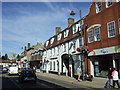
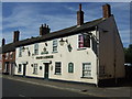
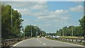
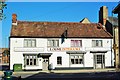
53 photos from this area
Area Information
Key information about the SG18 8BL including its size, population, and administrative classification.
- Area Type
- Postcode
- Area Size
- 7645 m²
- Population
- 1765
- Population Density
- 1040 people/km²
House Prices in SG18 8BL
41
Properties
£205,944
Average Sold Price
£57,500
Lowest Price
£440,000
Highest Price
Showing 41 properties
| Address | Type | Beds | Baths | Last Sale Price | Last Sale Date | |
|---|---|---|---|---|---|---|
| 107 Hitchin Street, Biggleswade, SG18 8BL | Terraced | 2 | 1 | £237,000 | May 2025 | |
| 86 Hitchin Street, Biggleswade, SG18 8BL | Detached | 3 | 2 | £440,000 | Jan 2025 | |
| 109 Hitchin Street, Biggleswade, SG18 8BL | Terraced | 2 | 1 | £250,000 | Apr 2022 | |
| 100 Hitchin Street, Biggleswade, SG18 8BL | Semi-detached | 3 | 2 | £385,000 | Mar 2022 | |
| 94 Hitchin Street, Biggleswade, SG18 8BL | Terraced | 2 | 1 | £242,500 | Sep 2021 | |
| 95 Hitchin Street, Biggleswade, SG18 8BL | Terraced | 3 | 1 | £303,500 | Jun 2021 | |
| 88 Hitchin Street, Biggleswade, SG18 8BL | house | - | - | £275,000 | Apr 2020 | |
| 92 Hitchin Street, Biggleswade, SG18 8BL | Terraced | 2 | 1 | £185,000 | Mar 2020 | |
| 90 Hitchin Street, Biggleswade, SG18 8BL | Semi-detached | 2 | - | £250,000 | Mar 2020 | |
| 101 Hitchin Street, Biggleswade, SG18 8BL | Terraced | 2 | 1 | £182,500 | Oct 2019 |
Page 1 of 5
Energy Efficiency in SG18 8BL
Amenities
Schools
| Rank | School | Type | Entry gender | Ages |
|---|
Explore more schools in this area
Go to Schools tabDemographics
Household Size
Two person
most common
Accommodation Type
Houses
most common
Tenure
64
majority
Ethnic Group
White
most common
Religion
N/A
most common
Household Composition
N/A
most common
Age
47
median
Adults (30-64 years)
most common
Household Deprivation
N/A
with no deprivation
NS-SEC
37
in Lower managerial occupations
Explore more demographic insights in this area
Go to Demographics tabPlanning
Planning Constraints
- Flood RiskPremium
- Ramsar Wetland SitesPremium
- Area of Outstanding Natural BeautyPremium
- Protected Nature ReservePremium
- Protected WoodlandPremium