Area Overview for SG15 6SD
Photos of SG15 6SD

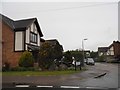
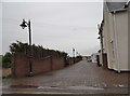
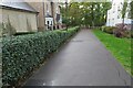
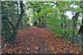
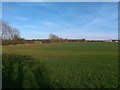
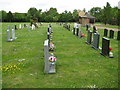

13 photos from this area
Area Information
Key information about the SG15 6SD including its size, population, and administrative classification.
- Area Type
- Postcode
- Area Size
- 8078 m²
- Population
- 2079
- Population Density
- 466 people/km²
House Prices in SG15 6SD
17
Properties
£231,944
Average Sold Price
£125,000
Lowest Price
£343,000
Highest Price
Showing 17 properties
| Address | Type | Beds | Baths | Last Sale Price | Last Sale Date | |
|---|---|---|---|---|---|---|
| 190 Hitchin Road, Arlesey, SG15 6SD | Detached | 2 | 1 | £343,000 | Oct 2018 | |
| 182 Hitchin Road, Arlesey, SG15 6SD | house | - | - | £273,000 | Nov 2015 | |
| 180 Hitchin Road, Arlesey, SG15 6SD | house | - | - | £233,000 | Jan 2013 | |
| 186 Hitchin Road, Arlesey, SG15 6SD | house | - | - | £200,000 | Sep 2011 | |
| 158 Hitchin Road, Arlesey, SG15 6SD | Detached | - | - | £338,500 | Apr 2009 | |
| 176 Hitchin Road, Arlesey, SG15 6SD | house | - | - | £310,000 | Apr 2009 | |
| 184 Hitchin Road, Arlesey, SG15 6SD | Semi-detached | 3 | - | £135,000 | May 2002 | |
| 198 Hitchin Road, Arlesey, SG15 6SD | Semi-detached | - | - | £130,000 | May 2001 | |
| 196 Hitchin Road, Arlesey, SG15 6SD | house | - | - | £125,000 | May 2001 | |
| 178 Hitchin Road, Arlesey, SG15 6SD | Detached | 3 | 1 | - | - |
Page 1 of 2
Energy Efficiency in SG15 6SD
Amenities
Schools
| Rank | School | Type | Entry gender | Ages |
|---|
Explore more schools in this area
Go to Schools tabDemographics
Household Size
Two person
most common
Accommodation Type
Houses
most common
Tenure
73
majority
Ethnic Group
White
most common
Religion
N/A
most common
Household Composition
N/A
most common
Age
47
median
Adults (30-64 years)
most common
Household Deprivation
N/A
with no deprivation
NS-SEC
36
in Lower managerial occupations
Explore more demographic insights in this area
Go to Demographics tabPlanning
Planning Constraints
- Flood RiskPremium
- Ramsar Wetland SitesPremium
- Area of Outstanding Natural BeautyPremium
- Protected Nature ReservePremium
- Protected WoodlandPremium