Area Overview for SG15 6AW
Photos of SG15 6AW
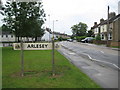
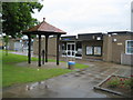
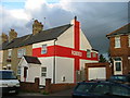
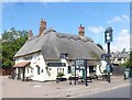
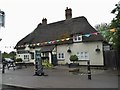
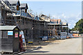
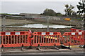
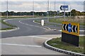
19 photos from this area
Area Information
Key information about the SG15 6AW including its size, population, and administrative classification.
- Area Type
- Postcode
- Area Size
- 1.3 hectares
- Population
- 2016
- Population Density
- 1042 people/km²
House Prices in SG15 6AW
29
Properties
£410,059
Average Sold Price
£82,250
Lowest Price
£599,950
Highest Price
Showing 29 properties
| Address | Type | Beds | Baths | Last Sale Price | Last Sale Date | |
|---|---|---|---|---|---|---|
| 23 Viney Corner, Arlesey, SG15 6AW | Retail | 4 | 1 | £485,000 | Dec 2022 | |
| 21 Viney Corner, Arlesey, SG15 6AW | Semi-detached | 4 | 2 | £489,950 | Dec 2021 | |
| 27 Viney Corner, Arlesey, SG15 6AW | house | - | - | £589,950 | Dec 2021 | |
| 25 Viney Corner, Arlesey, SG15 6AW | house | - | - | £494,950 | Dec 2021 | |
| 17 Viney Corner, Arlesey, SG15 6AW | Detached | 3 | 2 | £436,952 | Nov 2021 | |
| 15 Viney Corner, Arlesey, SG15 6AW | house | - | - | £599,950 | Nov 2021 | |
| 3 Viney Corner, Arlesey, SG15 6AW | house | - | - | £318,000 | Oct 2021 | |
| 1 Viney Corner, Arlesey, SG15 6AW | house | - | - | £589,950 | Sep 2021 | |
| 5 Viney Corner, Arlesey, SG15 6AW | house | - | - | £316,950 | Sep 2021 | |
| 9 Viney Corner, Arlesey, SG15 6AW | house | - | - | £106,750 | Sep 2021 |
Page 1 of 3
Energy Efficiency in SG15 6AW
Amenities
Schools
| Rank | School | Type | Entry gender | Ages |
|---|
Explore more schools in this area
Go to Schools tabDemographics
Household Size
Two person
most common
Accommodation Type
Houses
most common
Tenure
56
majority
Ethnic Group
White
most common
Religion
N/A
most common
Household Composition
N/A
most common
Age
47
median
Adults (30-64 years)
most common
Household Deprivation
N/A
with no deprivation
NS-SEC
32
in Lower managerial occupations
Explore more demographic insights in this area
Go to Demographics tabPlanning
Planning Constraints
- Flood RiskPremium
- Ramsar Wetland SitesPremium
- Area of Outstanding Natural BeautyPremium
- Protected Nature ReservePremium
- Protected WoodlandPremium