Area Overview for SG14 3QA
Photos of SG14 3QA
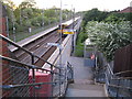
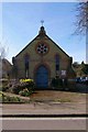
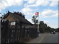
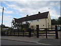
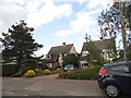
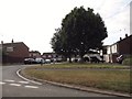
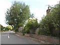
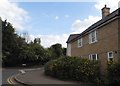
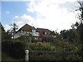
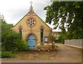
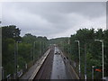
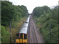
24 photos from this area
Area Information
Key information about the SG14 3QA including its size, population, and administrative classification.
- Area Type
- Postcode
- Area Size
- 1.4 hectares
- Population
- 2616
- Population Density
- 178 people/km²
House Prices in SG14 3QA
39
Properties
£412,347
Average Sold Price
£315,000
Lowest Price
£622,000
Highest Price
Showing 39 properties
| Address | Type | Beds | Baths | Last Sale Price | Last Sale Date | |
|---|---|---|---|---|---|---|
| 1 Clappers Lane, Watton At Stone, SG14 3QA | Terraced | 2 | 2 | £315,000 | Mar 2025 | |
| 20 Clappers Lane, Watton At Stone, SG14 3QA | house | 3 | 2 | £458,900 | Mar 2025 | |
| 5 Clappers Lane, Watton At Stone, SG14 3QA | Terraced | 2 | 1 | £395,000 | May 2024 | |
| 2 Clappers Lane, Watton At Stone, SG14 3QA | Detached | 3 | 2 | £622,000 | Aug 2023 | |
| 3 Clappers Lane, Watton At Stone, SG14 3QA | Terraced | 3 | 3 | £455,000 | Feb 2023 | |
| 8 Clappers Lane, Watton At Stone, SG14 3QA | Terraced | 3 | 1 | £440,000 | Dec 2022 | |
| 16 Clappers Lane, Watton At Stone, SG14 3QA | house | 2 | 1 | £315,000 | Mar 2022 | |
| 15 Clappers Lane, Watton At Stone, SG14 3QA | house | - | - | £542,500 | Jun 2021 | |
| 4 Clappers Lane, Watton At Stone, SG14 3QA | Terraced | 4 | 2 | £460,000 | Jan 2021 | |
| 24 Clappers Lane, Watton At Stone, SG14 3QA | Semi-detached | 3 | 2 | £416,000 | Oct 2020 |
Page 1 of 4
Energy Efficiency in SG14 3QA
Amenities
Schools
| Rank | School | Type | Entry gender | Ages |
|---|
Explore more schools in this area
Go to Schools tabDemographics
Household Size
Family (3-5 people)
most common
Accommodation Type
Houses
most common
Tenure
68
majority
Ethnic Group
White
most common
Religion
N/A
most common
Household Composition
N/A
most common
Age
47
median
Adults (30-64 years)
most common
Household Deprivation
N/A
with no deprivation
NS-SEC
45
in Lower managerial occupations
Explore more demographic insights in this area
Go to Demographics tabPlanning
Planning Constraints
- Flood RiskPremium
- Ramsar Wetland SitesPremium
- Area of Outstanding Natural BeautyPremium
- Protected Nature ReservePremium
- Protected WoodlandPremium