Area Overview for SG14 2TH
Photos of SG14 2TH
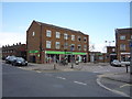
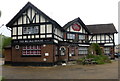
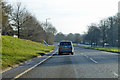
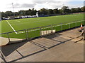
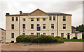
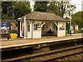


30 photos from this area
Area Information
Key information about the SG14 2TH including its size, population, and administrative classification.
- Area Type
- Postcode
- Area Size
- 1.7 hectares
- Population
- 1369
- Population Density
- 3173 people/km²
House Prices in SG14 2TH
59
Properties
£212,811
Average Sold Price
£42,500
Lowest Price
£430,000
Highest Price
Showing 59 properties
| Address | Type | Beds | Baths | Last Sale Price | Last Sale Date | |
|---|---|---|---|---|---|---|
| 83 Halleys Ridge, Hertford, SG14 2TH | Terraced | 1 | 1 | £295,000 | Nov 2025 | |
| 64 Halleys Ridge, Hertford, SG14 2TH | Maisonette | 1 | 1 | £251,000 | Oct 2025 | |
| 68 Halleys Ridge, Hertford, SG14 2TH | Terraced | 2 | 1 | £371,000 | Sep 2025 | |
| 58 Halleys Ridge, Hertford, SG14 2TH | Semi-detached | 4 | 2 | £430,000 | Sep 2025 | |
| 81 Halleys Ridge, Hertford, SG14 2TH | Terraced | 1 | 1 | £268,500 | Jun 2025 | |
| 107 Halleys Ridge, Hertford, SG14 2TH | Terraced | 1 | 1 | £280,000 | Feb 2025 | |
| 90 Halleys Ridge, Hertford, SG14 2TH | Terraced | 2 | 1 | £360,000 | Feb 2025 | |
| 52 Halleys Ridge, Hertford, SG14 2TH | Maisonette | 1 | 1 | £250,000 | Jan 2025 | |
| 56 Halleys Ridge, Hertford, SG14 2TH | Maisonette | 1 | 1 | £250,000 | Oct 2024 | |
| 102 Halleys Ridge, Hertford, SG14 2TH | Terraced | 1 | 1 | £265,000 | Jun 2024 |
Page 1 of 6
Energy Efficiency in SG14 2TH
Amenities
Schools
| Rank | School | Type | Entry gender | Ages |
|---|
Explore more schools in this area
Go to Schools tabDemographics
Household Size
Two person
most common
Accommodation Type
Houses
most common
Tenure
74
majority
Ethnic Group
White
most common
Religion
N/A
most common
Household Composition
N/A
most common
Age
47
median
Adults (30-64 years)
most common
Household Deprivation
N/A
with no deprivation
NS-SEC
47
in Lower managerial occupations
Explore more demographic insights in this area
Go to Demographics tabPlanning
Planning Constraints
- Flood RiskPremium
- Ramsar Wetland SitesPremium
- Area of Outstanding Natural BeautyPremium
- Protected Nature ReservePremium
- Protected WoodlandPremium