Area Overview for SG14 2PW
Photos of SG14 2PW


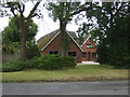
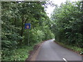
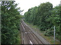
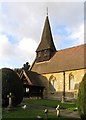

27 photos from this area
Area Information
Key information about the SG14 2PW including its size, population, and administrative classification.
- Area Type
- Postcode
- Area Size
- 16.1 hectares
- Population
- 1684
- Population Density
- 1181 people/km²
House Prices in SG14 2PW
6
Properties
£583,143
Average Sold Price
£550,000
Lowest Price
£616,285
Highest Price
Showing 6 properties
| Address | Type | Beds | Baths | Last Sale Price | Last Sale Date | |
|---|---|---|---|---|---|---|
| 206 North Road, Hertford, SG14 2PW | Detached | 4 | 3 | £616,285 | Nov 2015 | |
| The Lodge, 255 North Road, Hertford, SG14 2PW | Detached | - | - | £550,000 | Apr 2006 | |
| 234 North Road, Hertford, SG14 2PW | Bungalow | 4 | 2 | - | - | |
| Black Grove Lodge, 236 North Road, Hertford, SG14 2PW | Detached | 4 | 3 | - | - | |
| Crown Topiary, 234A North Road, Hertford, SG14 2PW | Farm | - | - | - | - | |
| Tree Heritage, 236A North Road, Hertford, SG14 2PW | shop | - | - | - | - |
Energy Efficiency in SG14 2PW
Amenities
Schools
| Rank | School | Type | Entry gender | Ages |
|---|
Explore more schools in this area
Go to Schools tabDemographics
Household Size
Family (3-5 people)
most common
Accommodation Type
Houses
most common
Tenure
46
majority
Ethnic Group
White
most common
Religion
N/A
most common
Household Composition
N/A
most common
Age
47
median
Adults (30-64 years)
most common
Household Deprivation
N/A
with no deprivation
NS-SEC
33
in Lower managerial occupations
Explore more demographic insights in this area
Go to Demographics tabPlanning
Planning Constraints
- Flood RiskPremium
- Ramsar Wetland SitesPremium
- Area of Outstanding Natural BeautyPremium
- Protected Nature ReservePremium
- Protected WoodlandPremium