Area Overview for SG14 2EN
Photos of SG14 2EN
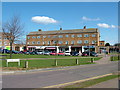
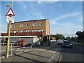
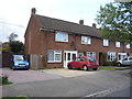
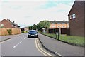
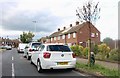
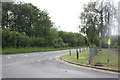


17 photos from this area
Area Information
Key information about the SG14 2EN including its size, population, and administrative classification.
- Area Type
- Postcode
- Area Size
- 1.4 hectares
- Population
- 1564
- Population Density
- 5949 people/km²
House Prices in SG14 2EN
38
Properties
£306,289
Average Sold Price
£120,000
Lowest Price
£485,000
Highest Price
Showing 38 properties
| Address | Type | Beds | Baths | Last Sale Price | Last Sale Date | |
|---|---|---|---|---|---|---|
| 1 Bentley Road, Hertford, SG14 2EN | Terraced | 3 | 2 | £485,000 | Apr 2025 | |
| 16A Bentley Road, Hertford, SG14 2EN | Terraced | 3 | 1 | £450,000 | May 2024 | |
| 13 Bentley Road, Hertford, SG14 2EN | Semi-detached | 3 | 1 | £456,000 | Apr 2023 | |
| 23 Bentley Road, Hertford, SG14 2EN | house | 3 | 1 | £397,500 | Jun 2022 | |
| 10 Bentley Road, Hertford, SG14 2EN | Terraced | 3 | - | £402,250 | Oct 2021 | |
| 5 Bentley Road, Hertford, SG14 2EN | house | - | - | £327,500 | Jun 2021 | |
| 6 Bentley Road, Hertford, SG14 2EN | house | - | - | £345,000 | May 2021 | |
| 16 Bentley Road, Hertford, SG14 2EN | Terraced | 2 | 1 | £351,000 | Mar 2020 | |
| 28 Bentley Road, Hertford, SG14 2EN | house | 3 | 1 | £355,000 | Mar 2020 | |
| 7 Bentley Road, Hertford, SG14 2EN | Terraced | 3 | 1 | £333,500 | Feb 2020 |
Page 1 of 4
Energy Efficiency in SG14 2EN
Amenities
Schools
| Rank | School | Type | Entry gender | Ages |
|---|
Explore more schools in this area
Go to Schools tabDemographics
Household Size
One person
most common
Accommodation Type
Houses
most common
Tenure
42
majority
Ethnic Group
White
most common
Religion
N/A
most common
Household Composition
N/A
most common
Age
47
median
Adults (30-64 years)
most common
Household Deprivation
N/A
with no deprivation
NS-SEC
32
in Lower managerial occupations
Explore more demographic insights in this area
Go to Demographics tabPlanning
Planning Constraints
- Flood RiskPremium
- Ramsar Wetland SitesPremium
- Area of Outstanding Natural BeautyPremium
- Protected Nature ReservePremium
- Protected WoodlandPremium