Area Overview for SG13 8RA
Photos of SG13 8RA
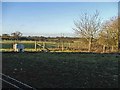
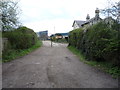
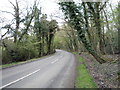
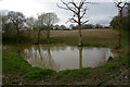
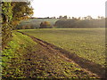
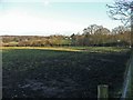
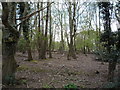
7 photos from this area
Area Information
Key information about the SG13 8RA including its size, population, and administrative classification.
- Area Type
- Postcode
- Area Size
- 12.9 hectares
- Population
- 1421
- Population Density
- 100 people/km²
House Prices in SG13 8RA
35
Properties
£543,021
Average Sold Price
£115,000
Lowest Price
£1,450,000
Highest Price
Showing 35 properties
| Address | Type | Beds | Baths | Last Sale Price | Last Sale Date | |
|---|---|---|---|---|---|---|
| 39 Newgate Street Village, Hertford, SG13 8RA | Semi-detached | 4 | 2 | £730,000 | Dec 2018 | |
| 4 Newgate Street Village, Hertford, SG13 8RA | Detached | 5 | 4 | £1,450,000 | Feb 2018 | |
| 37 Newgate Street Village, Hertford, SG13 8RA | Semi-detached | 4 | - | £490,000 | Aug 2015 | |
| 31 Newgate Street Village, Hertford, SG13 8RA | Detached | 3 | 2 | £567,500 | Aug 2014 | |
| 35 Newgate Street Village, Hertford, SG13 8RA | Detached | 3 | 1 | £530,000 | Jan 2014 | |
| 33 Newgate Street Village, Hertford, SG13 8RA | house | - | - | £500,000 | Sep 2011 | |
| 12 Newgate Street Village, Hertford, SG13 8RA | Detached | 4 | 3 | £585,000 | Mar 2007 | |
| 10 Newgate Street Village, Hertford, SG13 8RA | Detached | - | - | £486,250 | Sep 2005 | |
| 5 Newgate Street Village, Hertford, SG13 8RA | Detached | 4 | 2 | £430,000 | Jun 2004 | |
| 8 Newgate Street Village, Hertford, SG13 8RA | Semi-detached | - | - | £345,000 | Sep 2003 |
Page 1 of 4
Energy Efficiency in SG13 8RA
Amenities
Schools
| Rank | School | Type | Entry gender | Ages |
|---|
Explore more schools in this area
Go to Schools tabDemographics
Household Size
Family (3-5 people)
most common
Accommodation Type
Houses
most common
Tenure
83
majority
Ethnic Group
White
most common
Religion
N/A
most common
Household Composition
N/A
most common
Age
47
median
Adults (30-64 years)
most common
Household Deprivation
N/A
with no deprivation
NS-SEC
46
in Lower managerial occupations
Explore more demographic insights in this area
Go to Demographics tabPlanning
Planning Constraints
- Flood RiskPremium
- Ramsar Wetland SitesPremium
- Area of Outstanding Natural BeautyPremium
- Protected Nature ReservePremium
- Protected WoodlandPremium