Area Overview for SG13 8HY
Photos of SG13 8HY
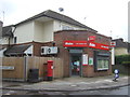
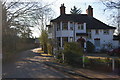
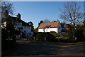
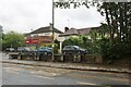
20 photos from this area
Area Information
Key information about the SG13 8HY including its size, population, and administrative classification.
- Area Type
- Postcode
- Area Size
- 1.5 hectares
- Population
- 1462
- Population Density
- 2106 people/km²
House Prices in SG13 8HY
42
Properties
£313,150
Average Sold Price
£120,000
Lowest Price
£602,500
Highest Price
Showing 42 properties
| Address | Type | Beds | Baths | Last Sale Price | Last Sale Date | |
|---|---|---|---|---|---|---|
| 44 Brickendon Lane, Hertford, SG13 8HY | Terraced | 3 | - | £485,000 | Feb 2025 | |
| 24 Brickendon Lane, Hertford, SG13 8HY | Semi-detached | 3 | 1 | £425,000 | Jan 2025 | |
| 82 Brickendon Lane, Hertford, SG13 8HY | Semi-detached | 3 | 1 | £460,000 | Jun 2024 | |
| 78 Brickendon Lane, Hertford, SG13 8HY | house | 3 | 1 | £432,000 | Feb 2023 | |
| 48 Brickendon Lane, Hertford, SG13 8HY | Retail | 3 | - | £602,500 | Sep 2022 | |
| 60 Brickendon Lane, Hertford, SG13 8HY | house | 4 | - | £450,000 | Jan 2022 | |
| 42 Brickendon Lane, Hertford, SG13 8HY | Terraced | 3 | 1 | £350,000 | Aug 2020 | |
| 68 Brickendon Lane, Hertford, SG13 8HY | house | - | - | £245,000 | Oct 2013 | |
| 76 Brickendon Lane, Hertford, SG13 8HY | house | - | - | £247,000 | Oct 2010 | |
| 30 Brickendon Lane, Hertford, SG13 8HY | house | - | - | £219,950 | Oct 2009 |
Page 1 of 5
Energy Efficiency in SG13 8HY
Amenities
Schools
| Rank | School | Type | Entry gender | Ages |
|---|
Explore more schools in this area
Go to Schools tabDemographics
Household Size
Family (3-5 people)
most common
Accommodation Type
Houses
most common
Tenure
53
majority
Ethnic Group
White
most common
Religion
N/A
most common
Household Composition
N/A
most common
Age
47
median
Adults (30-64 years)
most common
Household Deprivation
N/A
with no deprivation
NS-SEC
31
in Lower managerial occupations
Explore more demographic insights in this area
Go to Demographics tabPlanning
Planning Constraints
- Flood RiskPremium
- Ramsar Wetland SitesPremium
- Area of Outstanding Natural BeautyPremium
- Protected Nature ReservePremium
- Protected WoodlandPremium