Area Overview for SG13 8HS
Photos of SG13 8HS
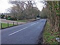
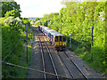
26 photos from this area
Area Information
Key information about the SG13 8HS including its size, population, and administrative classification.
- Area Type
- Postcode
- Area Size
- 2.9 hectares
- Population
- 1462
- Population Density
- 2106 people/km²
House Prices in SG13 8HS
64
Properties
£224,873
Average Sold Price
£95,000
Lowest Price
£420,000
Highest Price
Showing 64 properties
| Address | Type | Beds | Baths | Last Sale Price | Last Sale Date | |
|---|---|---|---|---|---|---|
| 84 Cecil Road, Hertford, SG13 8HS | Flat | - | - | £280,000 | Sep 2022 | |
| 72 Cecil Road, Hertford, SG13 8HS | Retail | 3 | 1 | £420,000 | Jun 2022 | |
| 68 Cecil Road, Hertford, SG13 8HS | house | - | - | £375,000 | May 2022 | |
| 94 Cecil Road, Hertford, SG13 8HS | Flat | 1 | 1 | £165,000 | Mar 2022 | |
| 119 Cecil Road, Hertford, SG13 8HS | Maisonette | 3 | 1 | £320,000 | Feb 2022 | |
| 127 Cecil Road, Hertford, SG13 8HS | Maisonette | - | - | £312,500 | Nov 2021 | |
| 98 Cecil Road, Hertford, SG13 8HS | Flat | 1 | 1 | £150,000 | Aug 2021 | |
| 66 Cecil Road, Hertford, SG13 8HS | Terraced | 3 | 1 | £330,000 | Oct 2020 | |
| 113 Cecil Road, Hertford, SG13 8HS | Flat | - | - | £219,000 | Nov 2018 | |
| 52 Cecil Road, Hertford, SG13 8HS | Terraced | 3 | 2 | £329,950 | Jun 2017 |
Page 1 of 7
Energy Efficiency in SG13 8HS
Amenities
Schools
| Rank | School | Type | Entry gender | Ages |
|---|
Explore more schools in this area
Go to Schools tabDemographics
Household Size
Family (3-5 people)
most common
Accommodation Type
Houses
most common
Tenure
53
majority
Ethnic Group
White
most common
Religion
N/A
most common
Household Composition
N/A
most common
Age
47
median
Adults (30-64 years)
most common
Household Deprivation
N/A
with no deprivation
NS-SEC
31
in Lower managerial occupations
Explore more demographic insights in this area
Go to Demographics tabPlanning
Planning Constraints
- Flood RiskPremium
- Ramsar Wetland SitesPremium
- Area of Outstanding Natural BeautyPremium
- Protected Nature ReservePremium
- Protected WoodlandPremium