Area Overview for SG13 8HH
Photos of SG13 8HH
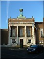
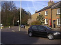
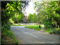
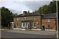
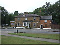
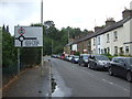
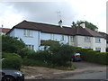
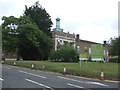
20 photos from this area
Area Information
Key information about the SG13 8HH including its size, population, and administrative classification.
- Area Type
- Postcode
- Area Size
- 1.2 hectares
- Population
- 1462
- Population Density
- 2106 people/km²
House Prices in SG13 8HH
37
Properties
£264,706
Average Sold Price
£75,000
Lowest Price
£484,000
Highest Price
Showing 37 properties
| Address | Type | Beds | Baths | Last Sale Price | Last Sale Date | |
|---|---|---|---|---|---|---|
| 33 Pearson Avenue, Hertford, SG13 8HH | Terraced | 3 | 2 | £484,000 | Oct 2024 | |
| 66 Pearson Avenue, Hertford, SG13 8HH | house | - | - | £421,000 | Jul 2022 | |
| 62 Pearson Avenue, Hertford, SG13 8HH | Flat | 1 | 1 | £185,000 | Jul 2022 | |
| 33A Pearson Avenue, Hertford, SG13 8HH | Detached | 2 | 1 | £375,000 | Apr 2022 | |
| 84 Pearson Avenue, Hertford, SG13 8HH | Flat | - | - | £179,995 | Jun 2021 | |
| 52 Pearson Avenue, Hertford, SG13 8HH | Terraced | 3 | 2 | £390,000 | Jun 2020 | |
| 78 Pearson Avenue, Hertford, SG13 8HH | Semi-detached | 2 | 1 | £347,000 | Jun 2020 | |
| 90 Pearson Avenue, Hertford, SG13 8HH | Flat | - | - | £214,000 | Dec 2018 | |
| 27 Pearson Avenue, Hertford, SG13 8HH | Terraced | 3 | 1 | £350,000 | Jan 2018 | |
| 39 Pearson Avenue, Hertford, SG13 8HH | Terraced | 3 | - | £249,000 | Dec 2014 |
Page 1 of 4
Energy Efficiency in SG13 8HH
Amenities
Schools
| Rank | School | Type | Entry gender | Ages |
|---|
Explore more schools in this area
Go to Schools tabDemographics
Household Size
Family (3-5 people)
most common
Accommodation Type
Houses
most common
Tenure
53
majority
Ethnic Group
White
most common
Religion
N/A
most common
Household Composition
N/A
most common
Age
47
median
Adults (30-64 years)
most common
Household Deprivation
N/A
with no deprivation
NS-SEC
31
in Lower managerial occupations
Explore more demographic insights in this area
Go to Demographics tabPlanning
Planning Constraints
- Flood RiskPremium
- Ramsar Wetland SitesPremium
- Area of Outstanding Natural BeautyPremium
- Protected Nature ReservePremium
- Protected WoodlandPremium