Area Overview for SG13 8EF
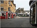
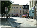
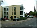
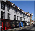
Photos of SG13 8EF


Area Information
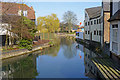
Living in SG13 8EF means settling into a small residential cluster defined by its specific postcode boundaries within Hertfordshire. This postcode covers a population of 1,303, creating a relatively tight-knit community where neighbours are likely to know one another's names. The area acts as a quiet pocket of Suburbia, positioned to offer residents a respite from the busiest parts of Hertford while remaining reachable by key transport links. Daily life here revolves around practical convenience rather than grand amenities, with most activities occurring within a short drive or walk from the homes. The character of SG13 8EF is straightforward and utilitarian, focusing on home ownership and stability rather than rapid development or commercial bustle. You live in an environment where the primary focus is the quality of the immediate surroundings and the ease of accessing local services. This makes the area suitable for those who prioritise a calm domestic setting over proximity to city centres or major entertainment hubs. The specific nature of this postcode ensures that life here is unhurried, allowing you to tailor your routine to personal needs without the congestion found in larger urban zones.
- Area Type
- Postcode
- Area Size
- Not available
- Population
- 1303
- Population Density
- 3790 people/km²
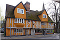
The property market in SG13 8EF is characterised by a split between owner-occupiers and rental tenants, with only 46% of the population owning their homes. The majority of residents therefore rent their properties, making this a mixed market with significant availability for both buyers and landlords. The predominant accommodation type is flats, which dictates the architectural nature of the stock and the density of the neighbourhood. Living in this postcode means you are likely to encounter high-density block living or converted urban-style housing rather than detached suburban villas. This housing stock appeals particularly to the working-age population mentioned in the demographics profile. The concentration of flats suggests that space is efficient here, with residents prioritising location over square footage. Buyers looking for freedom of modification will find the collective ownership or rental structures of these flats offer fewer renovation options compared to freehold houses. Conversely, owners benefit from the simplicity of maintaining a flat without the extensive grounds of a terrace or detached home. The market remains stable due to the fixed number of residents in this small area, preventing the volatile price swings seen in larger, rapidly developing districts.
House Prices in SG13 8EF
No properties found in this postcode.
Energy Efficiency in SG13 8EF
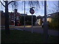
Your daily lifestyle in SG13 8EF relies on practical amenities located within easy reach of the residential cluster. Retail options include Aldi Hertford, M&S Hertford SF, and Sainsburys Hertford, all situated nearby to meet your grocery and clothing needs. These specific venues provide the essential shopping experience without requiring a journey into central Hertford. For travel, the area is serviced by five railway connections, notably Hertford East Railway Station, Hertford North Railway Station, and Ware Railway Station. Access to these stations allows you to commute to London or other parts of the East of England with ease. The concentration of retail and rail links means you do not need a private car for every trip. However, the reliance on these specific named amenities means the variety of luxury shopping or specialised dining may be limited compared to a city centre. You get the necessities efficiently, balancing the need for food and transport against the desire for a quieter residential experience. The layout supports a self-contained life where the basics are available without crossing town boundaries.
Amenities
Schools
Families considering SG13 8EF have access to Richard Hale School, which serves both primary and secondary education stages locally. This institution operates as an academy and holds a 'good' Ofsted rating, indicating a standard of education that meets the requirements set by regulators. The listing includes both a primary entry and an academy type entry for the same institution, suggesting a direct path from school to sixth form under the same umbrella. Having Richard Hale School nearby means parents do not need to commute far north or south to secure a place for their children. The good rating is a significant factor when comparing this area to others in Hertfordshire, where some schools may carry lower designations. This consistency in educational provision offers reassurance that the area supports family life effectively. There are no other schools listed in the immediate vicinity, so families must rely on this single main option or look further afield for alternatives. The proximity of this well-rated academy ensures that the educational needs of the community are largely met without requiring long travel times for students every morning.
| Rank | School | Type | Entry gender | Ages |
|---|
Explore more schools in this area
Go to Schools tabDemographics
The community within SG13 8EF is distinctly mature, reflecting a stable demographic profile. The median age for residents is 47, placing the area well above the national average and indicating a household base composed largely of established families or empty-nesters. Adults between the ages of 30 and 64 years constitute the most common age range, confirming that this is not a zone for young professionals or students but rather for settled living. Home ownership stands at 46%, showing that nearly half the residents have bought their properties outright or via mortgage, suggesting a desire for long-term investment and tenure. The predominant accommodation type consists of flats, which aligns with the demographic trend of downsizers or couples requiring efficient living spaces rather than large family houses. The population is predominantly White, matching the broader national trend in this region. This demographic consistency provides a predictable environment where social interactions are grounded in long-term residency patterns. There is no evidence of a transient population, meaning the social fabric remains stable. You can expect a quiet street life with minimal disruption from nightly student parties or locum workers constantly pitching tents in new housing developments nearby.
Household Size
Accommodation Type
Tenure
Ethnic Group
Religion
Household Composition
Age
Household Deprivation
NS-SEC
Explore more demographic insights in this area
Go to Demographics tabPlanning
Planning Constraints
- Flood RiskPremium
- Ramsar Wetland SitesPremium
- Area of Outstanding Natural BeautyPremium
- Protected Nature ReservePremium
- Protected WoodlandPremium