Area Overview for SG13 8AD
Photos of SG13 8AD
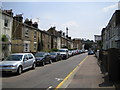
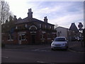
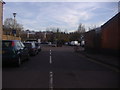
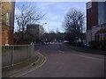
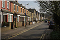
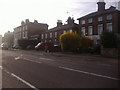
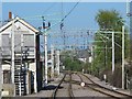
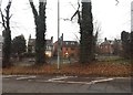
35 photos from this area
Area Information
Key information about the SG13 8AD including its size, population, and administrative classification.
- Area Type
- Postcode
- Area Size
- 1.0 hectares
- Population
- 2185
- Population Density
- 4391 people/km²
House Prices in SG13 8AD
27
Properties
£223,388
Average Sold Price
£42,000
Lowest Price
£415,000
Highest Price
Showing 27 properties
| Address | Type | Beds | Baths | Last Sale Price | Last Sale Date | |
|---|---|---|---|---|---|---|
| 22 Gwynns Walk, Hertford, SG13 8AD | Flat | 2 | - | £250,000 | Nov 2021 | |
| 15 Gwynns Walk, Hertford, SG13 8AD | Flat | - | - | £271,000 | Jun 2021 | |
| 8 Gwynns Walk, Hertford, SG13 8AD | Terraced | 3 | 1 | £356,500 | Sep 2020 | |
| 25 Gwynns Walk, Hertford, SG13 8AD | Flat | - | - | £245,000 | May 2019 | |
| 4 Gwynns Walk, Hertford, SG13 8AD | Terraced | 3 | 1 | £340,000 | Apr 2019 | |
| 13 Gwynns Walk, Hertford, SG13 8AD | house | 4 | 2 | £415,000 | Jan 2018 | |
| 6 Gwynns Walk, Hertford, SG13 8AD | house | 3 | 1 | £350,000 | Aug 2017 | |
| 10 Gwynns Walk, Hertford, SG13 8AD | Terraced | 3 | 1 | £397,000 | Jul 2017 | |
| 23 Gwynns Walk, Hertford, SG13 8AD | Flat | - | - | £240,000 | Jul 2017 | |
| 3 Gwynns Walk, Hertford, SG13 8AD | Semi-detached | 3 | 1 | £380,000 | Aug 2016 |
Page 1 of 3
Energy Efficiency in SG13 8AD
Amenities
Schools
| Rank | School | Type | Entry gender | Ages |
|---|
Explore more schools in this area
Go to Schools tabDemographics
Household Size
Two person
most common
Accommodation Type
Houses
most common
Tenure
63
majority
Ethnic Group
White
most common
Religion
N/A
most common
Household Composition
N/A
most common
Age
47
median
Adults (30-64 years)
most common
Household Deprivation
N/A
with no deprivation
NS-SEC
52
in Lower managerial occupations
Explore more demographic insights in this area
Go to Demographics tabPlanning
Planning Constraints
- Flood RiskPremium
- Ramsar Wetland SitesPremium
- Area of Outstanding Natural BeautyPremium
- Protected Nature ReservePremium
- Protected WoodlandPremium