Area Overview for SG13 7WN
Photos of SG13 7WN
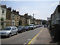
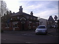
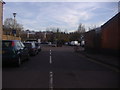
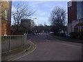
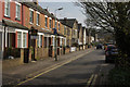
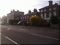
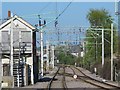
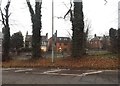


35 photos from this area
Area Information
Key information about the SG13 7WN including its size, population, and administrative classification.
- Area Type
- Postcode
- Area Size
- 1.4 hectares
- Population
- 2185
- Population Density
- 4391 people/km²
House Prices in SG13 7WN
54
Properties
£341,854
Average Sold Price
£100,000
Lowest Price
£685,000
Highest Price
Showing 54 properties
| Address | Type | Beds | Baths | Last Sale Price | Last Sale Date | |
|---|---|---|---|---|---|---|
| 52 Newland Gardens, Hertford, SG13 7WN | Terraced | 3 | 3 | £622,250 | Feb 2025 | |
| 9 Newland Gardens, Hertford, SG13 7WN | Flat | - | - | £393,000 | Dec 2024 | |
| 41 Newland Gardens, Hertford, SG13 7WN | Terraced | 3 | 2 | £615,000 | Aug 2024 | |
| 10 Newland Gardens, Hertford, SG13 7WN | Flat | - | - | £301,000 | Mar 2024 | |
| 36 Newland Gardens, Hertford, SG13 7WN | house | - | - | £650,000 | Jan 2024 | |
| 2 Newland Gardens, Hertford, SG13 7WN | Flat | 2 | 1 | £328,000 | Jan 2024 | |
| 12 Newland Gardens, Hertford, SG13 7WN | Flat | - | - | £335,000 | Aug 2023 | |
| 29 Newland Gardens, Hertford, SG13 7WN | Flat | - | - | £325,000 | Jul 2023 | |
| 45 Newland Gardens, Hertford, SG13 7WN | house | - | - | £685,000 | Nov 2022 | |
| 40 Newland Gardens, Hertford, SG13 7WN | Terraced | 4 | 3 | £600,000 | Mar 2022 |
Page 1 of 6
Energy Efficiency in SG13 7WN
Amenities
Schools
| Rank | School | Type | Entry gender | Ages |
|---|
Explore more schools in this area
Go to Schools tabDemographics
Household Size
Two person
most common
Accommodation Type
Houses
most common
Tenure
63
majority
Ethnic Group
White
most common
Religion
N/A
most common
Household Composition
N/A
most common
Age
47
median
Adults (30-64 years)
most common
Household Deprivation
N/A
with no deprivation
NS-SEC
52
in Lower managerial occupations
Explore more demographic insights in this area
Go to Demographics tabPlanning
Planning Constraints
- Flood RiskPremium
- Ramsar Wetland SitesPremium
- Area of Outstanding Natural BeautyPremium
- Protected Nature ReservePremium
- Protected WoodlandPremium