Area Overview for SG13 7RF
Photos of SG13 7RF
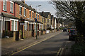
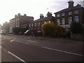
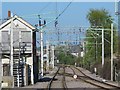
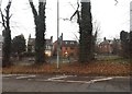

35 photos from this area
Area Information
Key information about the SG13 7RF including its size, population, and administrative classification.
- Area Type
- Postcode
- Area Size
- 1.4 hectares
- Population
- 2185
- Population Density
- 4391 people/km²
House Prices in SG13 7RF
26
Properties
£459,634
Average Sold Price
£260,000
Lowest Price
£662,500
Highest Price
Showing 26 properties
| Address | Type | Beds | Baths | Last Sale Price | Last Sale Date | |
|---|---|---|---|---|---|---|
| 5 Wisdom Drive, Hertford, SG13 7RF | house | 4 | 2 | £662,500 | Dec 2024 | |
| 2 Wisdom Drive, Hertford, SG13 7RF | Semi-detached | 4 | 2 | £650,000 | Feb 2023 | |
| 7 Wisdom Drive, Hertford, SG13 7RF | house | - | - | £645,000 | Apr 2022 | |
| 18 Wisdom Drive, Hertford, SG13 7RF | Semi-detached | 5 | 3 | £630,000 | Mar 2021 | |
| 25 Wisdom Drive, Hertford, SG13 7RF | Detached | 5 | 2 | £660,000 | Nov 2020 | |
| 3 Wisdom Drive, Hertford, SG13 7RF | Terraced | 4 | 2 | £595,000 | Aug 2017 | |
| 12 Wisdom Drive, Hertford, SG13 7RF | Semi-detached | 4 | 4 | £585,000 | Jul 2017 | |
| 9 Wisdom Drive, Hertford, SG13 7RF | Semi-detached | 4 | 2 | £525,000 | Sep 2016 | |
| 22 Wisdom Drive, Hertford, SG13 7RF | Semi-detached | - | - | £385,000 | Mar 2015 | |
| 1 Wisdom Drive, Hertford, SG13 7RF | Terraced | - | - | £460,000 | Nov 2014 |
Page 1 of 3
Energy Efficiency in SG13 7RF
Amenities
Schools
| Rank | School | Type | Entry gender | Ages |
|---|
Explore more schools in this area
Go to Schools tabDemographics
Household Size
Two person
most common
Accommodation Type
Houses
most common
Tenure
63
majority
Ethnic Group
White
most common
Religion
N/A
most common
Household Composition
N/A
most common
Age
47
median
Adults (30-64 years)
most common
Household Deprivation
N/A
with no deprivation
NS-SEC
52
in Lower managerial occupations
Explore more demographic insights in this area
Go to Demographics tabPlanning
Planning Constraints
- Flood RiskPremium
- Ramsar Wetland SitesPremium
- Area of Outstanding Natural BeautyPremium
- Protected Nature ReservePremium
- Protected WoodlandPremium