Area Overview for SG13 7NZ
Photos of SG13 7NZ

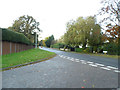
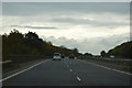
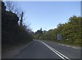
14 photos from this area
Area Information
Key information about the SG13 7NZ including its size, population, and administrative classification.
- Area Type
- Postcode
- Area Size
- 30.0 hectares
- Population
- 1467
- Population Density
- 820 people/km²
House Prices in SG13 7NZ
11
Properties
£741,916
Average Sold Price
£162,995
Lowest Price
£1,820,000
Highest Price
Showing 11 properties
| Address | Type | Beds | Baths | Last Sale Price | Last Sale Date | |
|---|---|---|---|---|---|---|
| Green Acres, Springle Lane, Hailey, SG13 7NZ | house | - | - | £1,212,000 | Oct 2020 | |
| Trevigue, Springle Lane, Hailey, SG13 7NZ | house | - | - | £1,820,000 | Jul 2013 | |
| Finches, Springle Lane, Hailey, Hoddesdon, SG13 7NZ | Detached | 4 | 2 | £442,500 | Oct 2005 | |
| Woodlands, Springle Lane, Hailey, SG13 7NZ | Detached | - | - | £290,000 | Dec 1998 | |
| The Bungalow, Springle Lane, Hailey, Hoddesdon, SG13 7NZ | Detached | - | - | £162,995 | Aug 1997 | |
| Springle House, Springle Lane, Hailey, SG13 7NZ | Detached | 8 | 2 | £524,000 | Feb 1995 | |
| Roseco Snack Bar, Mobile Snack Bar, Ware Road, Stanstead Abbotts, SG13 7NZ | Restaurant | - | - | - | - | |
| Rose Cottage, Springle Lane, Hailey, Hoddesdon, SG13 7NZ | house | - | - | - | - | |
| Brambling Rise, Springle Lane, Hailey, Hoddesdon, SG13 7NZ | Detached | - | - | - | - | |
| Hillside, Springle Lane, Hailey, SG13 7NZ | Detached | 3 | 2 | - | - |
Page 1 of 2
Energy Efficiency in SG13 7NZ
Amenities
Schools
| Rank | School | Type | Entry gender | Ages |
|---|
Explore more schools in this area
Go to Schools tabDemographics
Household Size
Family (3-5 people)
most common
Accommodation Type
Houses
most common
Tenure
63
majority
Ethnic Group
White
most common
Religion
N/A
most common
Household Composition
N/A
most common
Age
47
median
Adults (30-64 years)
most common
Household Deprivation
N/A
with no deprivation
NS-SEC
32
in Lower managerial occupations
Explore more demographic insights in this area
Go to Demographics tabPlanning
Planning Constraints
- Flood RiskPremium
- Ramsar Wetland SitesPremium
- Area of Outstanding Natural BeautyPremium
- Protected Nature ReservePremium
- Protected WoodlandPremium