Area Overview for SG13 7NH
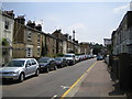
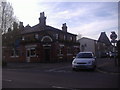
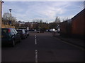
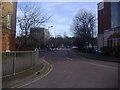
Photos of SG13 7NH


Area Information
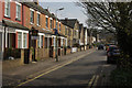
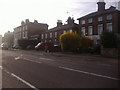
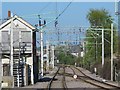
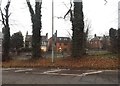
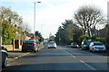
Living in SG13 7NH offers the stability of a established residential cluster within Hertfordshire. This specific postcode covers a small, tight-knit community with a total population of 2,185 residents. The area functions as a practical homebase for those seeking a settled environment away from the busiest city centres yet close enough to major transport hubs. You will find a setting dominated by family homes rather than high-rise blocks, creating a quiet landscape defined by its proximity to Hertford and Ware. The local character is shaped by long-term residents who value routine and neighbourhood familiarity. Daily life involves easy access to three distinct railway stations, allowing flexible commutes to London or other parts of the country. You will encounter a variety of essential services within a short practical reach, including Tesco Hertford, M&S Hertford SF, and Sainsburys Hertford. The postcode serves as a quiet anchor point where you can enjoy a slower pace while maintaining strong digital connectivity and straightforward travel links to the wider region.
- Area Type
- Postcode
- Area Size
- Not available
- Population
- 2185
- Population Density
- 4391 people/km²
The property market in SG13 7NH is characterised by a stable, owner-occupied environment. With 63% of households in this postcode owning their homes, the area functions far more as a settled community than a transient rental zone. You are more likely to purchase a home here than rent, as the housing stock consists primarily of houses rather than flats or apartments. This high rate of ownership suggests that many residents have lived in SG13 7NH for an extended period, contributing to a stable property market. When searching for homes in SG13 7NH, you should expect to look for traditional family residences that suit the median age of 47. The lack of prominent rental schemes or student accommodations points to a market driven by long-term buyers. This dynamic often means properties change hands less frequently, which can help preserve neighbourhood character. If you are an investor looking for short-term rentals or near-campus housing, this location may not suit your strategy. Instead, it appeals to those buying for their own use or as a long-term family investment. The dominance of houses ensures that the visual landscape remains consistent and residential.
House Prices in SG13 7NH
No properties found in this postcode.
Energy Efficiency in SG13 7NH
Residents of SG13 7NH enjoy convenient access to a range of retail and transport amenities within a short practical distance. For shopping needs, there are five notable retailers nearby, including Tesco Hertford, M&S Hertford SF, and Sainsburys Hertford. These supermarkets and stores provide you with everything required for daily errands and weekly shopping without the need for long journeys. For active travel and commuting, five railway stations serve the area, offering connections at Hertford East, Hertford North, and Ware Railway Station. This mix of retail and rail facilities ensures a balanced lifestyle where you can manage your home, work, и leisure needs efficiently. You do not need to venture far to find essential services or professional shopping. The presence of major chains like M&S and Tesco indicates a well-maintained commercial environment that stays clean and accessible. Combined with the good local amenities, living in SG13 7NH offers a practical solution for those who value convenience. You can balance a quiet residential life with easy access to the wider towns of Hertford and Ware. This accessibility is a key factor for commuters and parents who need to get out with ease.
Amenities
Schools
Families living in SG13 7NH have access to specific educational institutions that cater to different age groups and needs. The nearest primary education option is the Abel Smith School, which holds an outstanding Ofsted rating. This high-rating school provides excellent early education for younger children in the area. For older children or those requiring alternative education, the Hertford, Ware and Bishop's Stortford Area Pupil Referral Unit operates nearby as another important facility. The mix of school types means parents have access to both a high-performing mainstream primary and a specialized unit for other educational requirements. While there are no secondary schools explicitly listed in the immediate data for this postcode, the presence of a highly rated primary school like the Abel Smith School is a significant positive for local families. You do not need to rely on vague generalisations about the school catchment; the facts show a direct link to a top-rated primary institution. This ensures that if you move to this area, your children will have immediate access to quality primary education without long travel times. The proximity of these institutions adds practical value to living in SG13 7NH for any household with school-age children.
| Rank | School | Type | Entry gender | Ages |
|---|
Explore more schools in this area
Go to Schools tabDemographics
The community in SG13 7NH reflects a mature and stable population profile. The median age here stands at 47 years, confirming that most residents fall into the adult bracket between 30 and 64 years old. This age distribution indicates an area settled by families and older working-age professionals rather than young people or the retired elderly. Home ownership is a defining feature of the neighbourhood, with exactly 63% of households owning their property outright or through a mortgage. Houses constitute the primary accommodation type throughout SG13 7NH, meaning you will predominantly encounter detached or semi-detached properties rather than flats or terraced conversions. This housing stock aligns perfectly with the demographic, providing space for families and established households. The area is culturally homogenous, with the White ethnic group forming the predominant demographic. There is no indication of recent rapid redevelopment or large-scale student migration, which maintains a consistent community feel. These figures paint a picture of a ql used borhood where residents have put down roots.
Household Size
Accommodation Type
Tenure
Ethnic Group
Religion
Household Composition
Age
Household Deprivation
NS-SEC
Explore more demographic insights in this area
Go to Demographics tabPlanning
Planning Constraints
- Flood RiskPremium
- Ramsar Wetland SitesPremium
- Area of Outstanding Natural BeautyPremium
- Protected Nature ReservePremium
- Protected WoodlandPremium