Area Overview for SG13 7JA
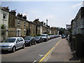
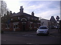
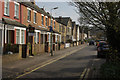
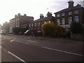
Photos of SG13 7JA


Area Information
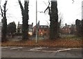
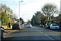
Living in SG13 7JA offers a distinct experience due to its small, specific residency cluster. This postcode covers a tightly knit residential area with a recorded population of 2,424 people. The density is significant, standing at 2,193 people per square kilometre, which creates an immediate sense of proximity between neighbours. You will find yourself in a neighbourhood where space is shared closely, fostering a community that feels present and active. The area functions as a self-contained hub for local daily life, removing the need to travel far for basic necessities. The character of SG13 7JA is defined by this concentrated population, ensuring that residents have immediate access to one another. Unlike sprawling suburbs, homes here sit close together, creating an environment where local interaction is part of the routine. This density brings vibrancy but also requires a lifestyle adapted to a more compact living environment. You should understand that moving into SG13 7JA means joining a specific, defined group rather than a diffuse suburban sprawl. The area remains practical and functional, prioritising direct access to essential services over open spaces or large detached distances between properties.
- Area Type
- Postcode
- Area Size
- Not available
- Population
- 2424
- Population Density
- 2193 people/km²
The property market in SG13 7JA is characterised by a dominance of owner-occupied housing. With 73% of residents owning their homes, the area is far removed from a high-rental market where landlords turn over tenants frequently. This high ownership rate typically signals stability and long-term residency. The accommodation type available consists entirely of houses. You will not find flats or purpose-built blocks within this specific postcode. This housing stock suits families and individuals who prefer a standalone dwelling with private access. Looking at SG13 7JA, you are buying into a market where sellers generally have an emotional and financial stake in the outcome of the sale. The local estate might show mostly family homes rather than niche conversions or high-density projects. This uniformity makes assessing property value straightforward; you know exactly what you are getting; a house in a specific, defined context. For a buyer, this means fewer surprises regarding building type or shared maintenance responsibilities. The market reflects the demographic reality of a settled, middle-aged population who have already secured their tenure. When viewing homes in SG13 7JA, expect legacy stock that has been maintained by owners who intend to stay.
House Prices in SG13 7JA
No properties found in this postcode.
Energy Efficiency in SG13 7JA
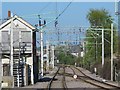
Daily life in SG13 7JA benefits from a cluster of nearby amenities within a short practical distance. Five retail outlets are situated close by, including the large Tesco Hertford and M&S locations at both Hertford South Freeport and Rush Green BP. These specific venues provide comprehensive grocery shopping and general retail needs without requiring a long car journey. For rail enthusiasts or travelers, five stations including Hertford East Railway Station, Hertford North Railway Station, and Ware Railway Station are immediately accessible. This concentration of retail and transport hubs defines the convenience of SG13 7JA. You can access five distinct shopping points and five different railway stations, creating a versatile lifestyle for residents. The proximity of M&S and Tesco means you can shop locally for bread, milk, and weekly groceries. The presence of these five notable retail locations and five railway stations supports a busy, active lifestyle. Living in SG13 7JA grants you ready access to major chain stores and efficient public transport links. The area functions as a practical base where essential services are located just beyond the doorstep, suitably supporting the needs of a mature, house-dwelling population.
Amenities
Schools
Education access in SG13 7JA is centred around a single key institution within the data scope. Wheatcroft Primary School serves the local community as a primary education provider. The school holds a 'good' Ofsted rating, providing assurance of a standard curriculum and competent management. As SG13 7JA consists mainly of houses and excludes flats, the population likely includes families with children of school age. The presence of this primary school supports the demographic profile of adults aged 30 to 64 years. This concentration suggests that families living in SG13 7JA rely on this one primary establishment for their children's early education. You will not find secondary schools or alternative educational types listed for this specific postcode, which indicates the immediate need to look at neighbouring towns for older children. The 'good' rating from inspectors is a stable statistic that remains relevant for prospective homebuyers. When schools near SG13 7JA are evaluated, Wheatcroft Primary School stands as the sole reference point for primary education quality. This limited but reliable supply aligns with the low-density, owner-occupied nature of the housing stock.
| Rank | School | Type | Entry gender | Ages |
|---|
Explore more schools in this area
Go to Schools tabDemographics
The community in SG13 7JA is defined by a mature and stable age profile. The median age is 47 years, with the most common age range comprising adults between 30 and 64 years old. This demographic skew indicates a neighbourhood populated by working families, established parents, and individuals in their middle years. You will primarily encounter residents who have already navigated the early stages of adulthood and are now focused on long-term stability. Seventy-three per cent of households here own their homes, a figure that significantly exceeds average rates for many urban areas. This high level of home ownership underscores the nature of SG13 7JA as a settled area rather than a transient rental hub. The accommodation type is exclusively houses, eliminating the presence of apartment blocks or smaller terraced builds often found in denser city centres. Residents are overwhelmingly White, reflecting a homogenous community structure. These hard figures paint a clear picture of a quiet, owner-occupied locale where people put down roots. The age profile and ownership rate suggest a low turnover of residents, meaning neighbours are likely to remain in the same properties for many years. This consistency fosters a predictable environment for those seeking a traditional suburban house in SG13 7JA.
Household Size
Accommodation Type
Tenure
Ethnic Group
Religion
Household Composition
Age
Household Deprivation
NS-SEC
Explore more demographic insights in this area
Go to Demographics tabPlanning
Planning Constraints
- Flood RiskPremium
- Ramsar Wetland SitesPremium
- Area of Outstanding Natural BeautyPremium
- Protected Nature ReservePremium
- Protected WoodlandPremium