Area Overview for SG13 7HT
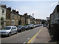
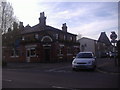
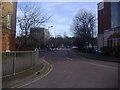
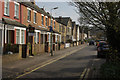
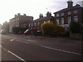
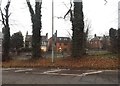
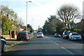
Photos of SG13 7HT


Area Information
Living in SG13 7HT offers a quiet residential experience centred on a specific postcode cluster in Hertfordshire. The area holds a defined population of 2,185 people, creating an intimate neighbourhood feel rather than a sprawling suburb. Most residents rent or own homes within this tight-knit circle, enjoying a lifestyle characterised by stability and local familiarity. The demographic profile indicates a mature community, with the majority of residents falling into the adult age bracket of 30 to 64 years. This suggests a neighbourhood where families with older children or empty nesters might dominate the street scene. You will find housing stock is overwhelmingly comprised of houses, reflecting a traditional suburban layout common in the region. The absence of major planning constraints or protected environmental sites means development restrictions focus only on the essential challenges of urban living. Daily life here feels grounded and practical, free from the unpredictability of flood risks or the limitations imposed by designated nature reserves. For those seeking a straightforward address in Hertfordshire without complex environmental overlays, SG13 7HT presents a clear, bounded community defined by its residential density and established layout.
- Area Type
- Postcode
- Area Size
- Not available
- Population
- 2185
- Population Density
- 4391 people/km²
Homes in SG13 7HT belong to a market dominated by owner-occupiers rather than investors or short-term renters. With a home ownership rate of 63 per cent, the majority of residents have purchased their homes with the intention of staying in the area for the long term. The accommodation type confirms this trend, as houses account for the bulk of the residential stock. This composition creates a neighbourhood where property values tend to reflect the desires of families and downsizers rather than cash buyers seeking rental yields. You are unlikely to find a high concentration of buy-to-let properties or multi-unit housing blocks disrupting the street pattern. Instead, the market reflects a标准为 residential community where tenants who do exist usually reside in the remaining 37 per cent of non-owned homes. For buyers seeking stability, the evidence suggests that houses here are held by people who intend to maintain them. This reduces the turnover of residents and keeps local customs and architectural styles consistent over time. The lack of mixed-use planning constraints further supports a housing environment focused primarily on private dwellings.
House Prices in SG13 7HT
No properties found in this postcode.
Energy Efficiency in SG13 7HT
Residents of SG13 7HT enjoy practical access to key amenities within a short travel radius, ensuring daily needs are met without requiring long commutes. Retail options are plentiful, with five notable shops including Tesco Hertford, M&S Hertford SF, and Sainsburys Hertford located nearby. These supermarkets and department stores provide comprehensive shopping coverage for groceries, clothing, and household essentials. Transport links are equally convenient, with five railway stations offering rail services for those who do not rely on cars. Hertford East Railway Station, Hertford North Railway Station, and Ware Railway Station provide frequent connections to London and other major cities. You do not need to travel far to find dining, shopping, or transit options that enhance your daily convenience. This balance of local retail and major transport hubs makes SG13 7HT a functional base for anyone working in surrounding conurbations or preferring city centre access. The availability of these five retail outlets and three major stations ensures that isolation is never a concern for the local population.
Amenities
Schools
Families in SG13 7HT have access to specific educational institutions within their immediate reach. Abel Smith School stands out as a primary school with an outstanding Ofsted rating, offering a high standard of early education for younger children. Located nearby, this institution provides a foundation of academic excellence that parents consider vital when choosing a home. The area also hosts the Hertford, Ware and Bishop's Stortford Area Pupil Referral Unit, which serves a different educational purpose for students requiring alternative learning arrangements. While there is no secondary school listed in the immediate vicinity of this specific postcode, the presence of a highly rated primary school anchors the educational landscape. For residents living in SG13 7HT, the proximity to Abel Smith School is a tangible benefit for households with young children. The mix of routine primary provision and specialist pupil referral support indicates a comprehensive local infrastructure designed to manage diverse learning needs. Parents relying on schools near this area can expect a primary option with top-tier government performance ratings.
| Rank | School | Type | Entry gender | Ages |
|---|
Explore more schools in this area
Go to Schools tabDemographics
The community profile of SG13 7HT reveals a population Anchored firmly in the working age range. Adults aged 30 to 64 years constitute the most common age group, reflecting a demographic with significant life experience and financial stability. The median age sits at 47 years, confirming a mature household structure where younger families and young professionals are less prevalent than middle-aged adults. Home ownership is a defining feature of the area, with 63 per cent of residents owning their properties outright or with a mortgage. This figure far exceeds the national average for many urban zones and indicates a long-term commitment to the locality. The majority of accommodation consists of houses, aligning with the preference for private gardens and detached living spaces found in Hertfordshire. Ethnically, White residents form the predominant group within the postcode. You will encounter a community built on established roots rather than transient populations. This demographic consistency provides a predictable environment where neighbours have known each other for generations, fostering a sense of security that newer areas often lack.
Household Size
Accommodation Type
Tenure
Ethnic Group
Religion
Household Composition
Age
Household Deprivation
NS-SEC
Explore more demographic insights in this area
Go to Demographics tabPlanning
Planning Constraints
- Flood RiskPremium
- Ramsar Wetland SitesPremium
- Area of Outstanding Natural BeautyPremium
- Protected Nature ReservePremium
- Protected WoodlandPremium