Area Overview for SG13 7AQ
Photos of SG13 7AQ

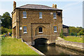
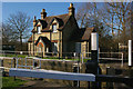
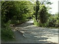
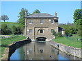
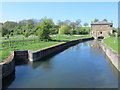
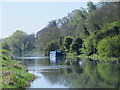
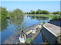
87 photos from this area
Area Information
Key information about the SG13 7AQ including its size, population, and administrative classification.
- Area Type
- Postcode
- Area Size
- 7761 m²
- Population
- 2424
- Population Density
- 2193 people/km²
House Prices in SG13 7AQ
16
Properties
£310,503
Average Sold Price
£70,000
Lowest Price
£468,530
Highest Price
Showing 16 properties
| Address | Type | Beds | Baths | Last Sale Price | Last Sale Date | |
|---|---|---|---|---|---|---|
| 15 Marshgate Drive, Hertford, SG13 7AQ | Terraced | 3 | 2 | £425,000 | Aug 2024 | |
| 11 Marshgate Drive, Hertford, SG13 7AQ | Terraced | 3 | 3 | £395,000 | Jul 2023 | |
| 19 Marshgate Drive, Hertford, SG13 7AQ | Terraced | 3 | 1 | £439,000 | Mar 2023 | |
| 17 Marshgate Drive, Hertford, SG13 7AQ | Terraced | 4 | - | £468,530 | Oct 2022 | |
| 25 Marshgate Drive, Hertford, SG13 7AQ | Terraced | 3 | 1 | £440,000 | Sep 2020 | |
| 9 Marshgate Drive, Hertford, SG13 7AQ | Terraced | 4 | 2 | £426,000 | Apr 2017 | |
| 27 Marshgate Drive, Hertford, SG13 7AQ | Terraced | 3 | - | £325,000 | Mar 2017 | |
| 21 Marshgate Drive, Hertford, SG13 7AQ | Terraced | 2 | 1 | £250,000 | Oct 2013 | |
| 23 Marshgate Drive, Hertford, SG13 7AQ | house | - | - | £180,000 | Feb 2012 | |
| 5 Marshgate Drive, Hertford, SG13 7AQ | house | 2 | - | £220,000 | Mar 2011 |
Page 1 of 2
Energy Efficiency in SG13 7AQ
Amenities
Schools
| Rank | School | Type | Entry gender | Ages |
|---|
Explore more schools in this area
Go to Schools tabDemographics
Household Size
Family (3-5 people)
most common
Accommodation Type
Houses
most common
Tenure
73
majority
Ethnic Group
White
most common
Religion
N/A
most common
Household Composition
N/A
most common
Age
47
median
Adults (30-64 years)
most common
Household Deprivation
N/A
with no deprivation
NS-SEC
50
in Lower managerial occupations
Explore more demographic insights in this area
Go to Demographics tabPlanning
Planning Constraints
- Flood RiskPremium
- Ramsar Wetland SitesPremium
- Area of Outstanding Natural BeautyPremium
- Protected Nature ReservePremium
- Protected WoodlandPremium