Area Overview for SG12 9PU
Photos of SG12 9PU
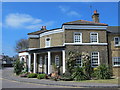

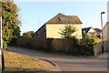
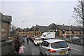
62 photos from this area
Area Information
Key information about the SG12 9PU including its size, population, and administrative classification.
- Area Type
- Postcode
- Area Size
- 7096 m²
- Population
- 1638
- Population Density
- 2675 people/km²
House Prices in SG12 9PU
82
Properties
£206,094
Average Sold Price
£31,500
Lowest Price
£421,000
Highest Price
Showing 82 properties
| Address | Type | Beds | Baths | Last Sale Price | Last Sale Date | |
|---|---|---|---|---|---|---|
| 55, Millacres, Station Road, Ware, SG12 9PU | Flat | 2 | 1 | £283,000 | May 2025 | |
| 17, Millacres, Station Road, Ware, SG12 9PU | Flat | 1 | 1 | £245,000 | Mar 2025 | |
| 78, Millacres, Station Road, Ware, SG12 9PU | Flat | - | - | £225,000 | Nov 2024 | |
| 54, Millacres, Station Road, Ware, SG12 9PU | Flat | - | - | £285,000 | Sep 2024 | |
| 68, Millacres, Station Road, Ware, SG12 9PU | Flat | - | - | £250,000 | Apr 2024 | |
| 28, Millacres, Station Road, Ware, SG12 9PU | Flat | - | - | £238,000 | Feb 2024 | |
| 42, Millacres, Station Road, Ware, SG12 9PU | Flat | - | - | £294,000 | Feb 2024 | |
| 48, Millacres, Station Road, Ware, SG12 9PU | Flat | - | - | £320,000 | Jun 2023 | |
| 35, Millacres, Station Road, Ware, SG12 9PU | Flat | 2 | 2 | £257,241 | Apr 2023 | |
| 69, Millacres, Station Road, Ware, SG12 9PU | Flat | - | - | £290,000 | Mar 2023 |
Page 1 of 9
Energy Efficiency in SG12 9PU
Amenities
Schools
| Rank | School | Type | Entry gender | Ages |
|---|
Explore more schools in this area
Go to Schools tabDemographics
Household Size
One person
most common
Accommodation Type
Flats
most common
Tenure
55
majority
Ethnic Group
White
most common
Religion
N/A
most common
Household Composition
N/A
most common
Age
47
median
Adults (30-64 years)
most common
Household Deprivation
N/A
with no deprivation
NS-SEC
47
in Lower managerial occupations
Explore more demographic insights in this area
Go to Demographics tabPlanning
Planning Constraints
- Flood RiskPremium
- Ramsar Wetland SitesPremium
- Area of Outstanding Natural BeautyPremium
- Protected Nature ReservePremium
- Protected WoodlandPremium