Area Overview for SG12 9HR
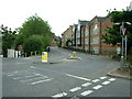
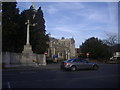
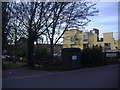
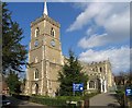
Photos of SG12 9HR


Area Information
The postcode SG12 9HR represents a compact residential cluster in Hertfordshire, serving a population of 1,621 people. This specific area is situated within the wider Ware and Hertford hinterland, offering a settled environment for long-term residents. The small footprint results in a high density of 944 people per square kilometre, creating a relatively enclosed community feel. Living in SG12 9HR means accessing a neighbourhood where daily routines are supported by immediate proximity to local services and rail links. The area functions as a quiet residential stopover rather than a commercial hub, prioritising domestic tranquility over urban bustle. Prospective buyers entering this cluster typically seek established homes rather than new developments, given the mature nature of the population. The location strikes a balance between village privacy and town amenities, ensuring that essential needs are never far away. Its position allows for straightforward integration into the Hertfordshire transport network while maintaining a distinct local identity. For those wishing to buy homes in SG12 9HR, the demographic stability and high home ownership rates suggest a community focused on permanence and family stability.
- Area Type
- Postcode
- Area Size
- Not available
- Population
- 1621
- Population Density
- 944 people/km²
The property market in SG12 9HR is defined by a strong preference for permanent ownership and traditional housing structures. With 79% of residents owning their homes, the area operates primarily as an owner-occupied zone rather than a rental market. This high ownership rate often indicates stable, well-maintained properties that have been updated over successive generations. Houses dominate the accommodation type data, meaning buyers looking for bungalows, detached homes, or semi-detached houses will find the most suitable options here. The absence of significant flat or apartment stock aligns with the rural-urban fringe character of the postcode. Potential buyers considering homes in SG12 9HR should expect a market driven by leasehold or freehold single-family dwellings rather than shared ownership schemes or rental leases. The high density of 944 people per square kilometre is consistent with a tightly packed row of housing, suggesting limited space for large new-build developments. This mature market means that property values reflect the quality and condition of individual houses rather than speculative new construction. Homebuyers here are typically purchasing with a long-term view, securing their place in a community where 80% of neighbours are already committed landowners.
House Prices in SG12 9HR
No properties found in this postcode.
Energy Efficiency in SG12 9HR
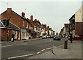
Residents of SG12 9HR enjoy convenient access to a variety of retail and transport hubs within a short practical distance. The local retail scene includes Morrisons Daily, Tesco Ware, and Sainsburys Ware, providing ample opportunities for grocery shopping and household essentials without the need for long drives. For those commuting by train, the area is well-positioned near Ware Railway Station, Hertford East Railway Station, and St Margarets Railway Station. These rail links connect the residential cluster to major commercial centres, ensuring that travel to work remains efficient despite the quiet residential nature of the postcode. The presence of five notable retail outlets and five nearby rail stations creates a supportive infrastructure that underpins daily life. Shoppers can easily compare prices and stock between Tesco Ware and Sainsburys Ware, while the proximity of Ware Railway Station offers flexible travel options throughout the day. This blend of local convenience and regional connectivity means that residents do not have to compromise between living in a peaceful home and maintaining a busy social or professional schedule. The area balances the quiet of home life with the utility of readily available services, making it a practical choice for commuters and families alike.
Amenities
Schools
Living families in SG12 9HR benefit from a selection of educational institutions located within practical commuting distance. The nearest primary education options include Sacred Heart Catholic Primary School and Presdales School, both of which provide foundational learning for younger children in the region. For alternative or specialist needs, Pinewood School and Middleton School serve the local area with special educational provisions tailored to specific learning requirements. As children progress to secondary age, Hertford Regional College offers sixth-form education and further vocational training, extending support well beyond standard high school years. This mixture of primary schools, special schools, and a regional sixth-form college ensures that educational pathways remain accessible without unnecessary travel times. The presence of Sacred Heart Catholic Primary School indicates a community with traditions, while Presdales School serves the broader catchment area with similar primary provisions. Families living in SG12 9HR do not face significant barriers to accessing schooling, as these institutions are integrated into the wider Hertfordshire network. The inclusion of Hertford Regional College provides a crucial academic bridge for older students seeking higher education or apprenticeship routes before entering the workforce full-time.
| Rank | School | Type | Entry gender | Ages |
|---|
Explore more schools in this area
Go to Schools tabDemographics
Residents of SG12 9HR form an established community with an average median age of 47 years. The majority of the local population comprises adults between 30 and 64 years old, indicating a demographic dominated by families or individuals in their prime working years. Home ownership stands at a robust 79%, which is significantly higher than the national average and signals a deep-rooted local investment. This high proportion of owner-occupiers suggests that most households view the area as a base for their long-term future rather than a temporary rental arrangement. Houses constitute the primary accommodation type, reflecting a traditional suburban or semi-rural housing stock rather than a mix of flats or apartments. The area is predominantly White, aligning with broader regional trends in the Hertfordshire countryside. The adult-focused age profile implies a neighbourhood where children are likely to be present in school-aged groups, with fewer single-person households typically found in younger urban centres. This demographic stability contributes to a consistent demand for local schools and steady community involvement.
Household Size
Accommodation Type
Tenure
Ethnic Group
Religion
Household Composition
Age
Household Deprivation
NS-SEC
Explore more demographic insights in this area
Go to Demographics tabPlanning
Planning Constraints
- Flood RiskPremium
- Ramsar Wetland SitesPremium
- Area of Outstanding Natural BeautyPremium
- Protected Nature ReservePremium
- Protected WoodlandPremium