Area Overview for SG12 9DX
Photos of SG12 9DX
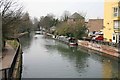

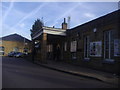
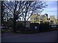
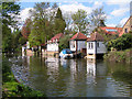

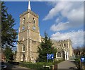
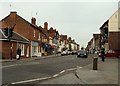
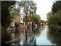
100 photos from this area
Area Information
Key information about the SG12 9DX including its size, population, and administrative classification.
- Area Type
- Postcode
- Area Size
- 6818 m²
- Population
- 2130
- Population Density
- 6801 people/km²
House Prices in SG12 9DX
28
Properties
£312,230
Average Sold Price
£74,995
Lowest Price
£446,000
Highest Price
Showing 28 properties
| Address | Type | Beds | Baths | Last Sale Price | Last Sale Date | |
|---|---|---|---|---|---|---|
| 15 Coronation Road, Ware, SG12 9DX | Terraced | 2 | 1 | £415,000 | Feb 2025 | |
| 21 Coronation Road, Ware, SG12 9DX | Terraced | 2 | 1 | £446,000 | Apr 2024 | |
| 7 Coronation Road, Ware, SG12 9DX | house | - | - | £323,000 | Jun 2023 | |
| 19 Coronation Road, Ware, SG12 9DX | Terraced | 2 | - | £416,000 | Sep 2022 | |
| 20 Coronation Road, Ware, SG12 9DX | Terraced | 2 | - | £425,000 | Sep 2021 | |
| 22 Coronation Road, Ware, SG12 9DX | house | - | - | £442,500 | Sep 2021 | |
| 6 Coronation Road, Ware, SG12 9DX | Terraced | 2 | 1 | £365,000 | Sep 2020 | |
| 12 Coronation Road, Ware, SG12 9DX | house | 2 | 1 | £190,000 | Jun 2019 | |
| 14 Coronation Road, Ware, SG12 9DX | house | - | - | £190,000 | Jun 2019 | |
| 16 Coronation Road, Ware, SG12 9DX | house | - | - | £411,500 | Aug 2017 |
Page 1 of 3
Energy Efficiency in SG12 9DX
Amenities
Schools
| Rank | School | Type | Entry gender | Ages |
|---|
Explore more schools in this area
Go to Schools tabDemographics
Household Size
One person
most common
Accommodation Type
Flats
most common
Tenure
55
majority
Ethnic Group
White
most common
Religion
N/A
most common
Household Composition
N/A
most common
Age
47
median
Adults (30-64 years)
most common
Household Deprivation
N/A
with no deprivation
NS-SEC
43
in Lower managerial occupations
Explore more demographic insights in this area
Go to Demographics tabPlanning
Planning Constraints
- Flood RiskPremium
- Ramsar Wetland SitesPremium
- Area of Outstanding Natural BeautyPremium
- Protected Nature ReservePremium
- Protected WoodlandPremium