Area Overview for SG12 8XB
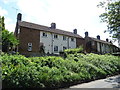
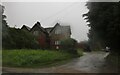
Photos of SG12 8XB


Area Information
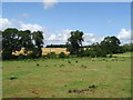
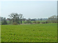
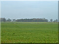
Living in SG12 8XB means residing within a specific postcode cluster that forms part of Greater London, located in England. This area has a total population of 1,435 people, creating a compact residential community with a density of 137 people per square kilometre. The small size of this cluster results in close-knit relations among neighbours and a distinct atmosphere different from larger suburban towns. You will find a very small residential cluster here, making it easy to recognise faces during your morning walk or evening commute. The scale of the area is intimate, which appeals to those who prefer a quiet environment over urban sprawl. Daily life revolves around the immediate surroundings rather than distant city centres, though connectivity to wider areas remains strong. The location offers a balance between seclusion and access to services, suited for families or individuals seeking a tranquil domestic setting. Understanding the true scale of SG12 8XB helps you realise that this is a specific enclave rather than a broad district. Your neighbours know you, and community events likely spread quickly through word of mouth. This demographic size supports independent local shops while maintaining accessibility to larger retail outlets nearby. The area's character is defined by its modest footprint, where every household neighbour is potentially a neighbour. You gain immediate awareness of local changes, from roadworks to new arrivals. This direct engagement fosters a sense of ownership over the neighbourhood.
- Area Type
- Postcode
- Area Size
- Not available
- Population
- 1435
- Population Density
- 137 people/km²
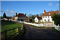
The property market in SG12 8XB is defined by a high rate of home ownership, which sits at 60 per cent. This statistic indicates that the majority of residents do not rent their homes. Instead, they possess freehold or leasehold titles to their properties. The predominant accommodation type in this area consists of houses, which differ from flats or apartments common in urban centres. You will find single-family homes rather than high-density blocks of living accommodation. This housing stock appeals to buyers seeking gardens and private outdoor space. The high ownership percentage suggests stability in the local market and potentially lower vacancy rates. Renters constitute a minority compared to owner-occupiers here, reducing the likelihood of frequent tenant turnover. When looking at homes in SG12 8XB, expect traditional UK residential architecture suited to family life. The small population of 1,435 people limits the number of available properties available for sale or purchase. This scarcity can make competition for specific homes intense if supply remains low. Buyers should act quickly when a suitable house comes to the market. Existing owners appreciate their investments and often stick long-term, resisting relocation to large housing developments. The area lacks rental-heavy blocks, reinforcing its character as a family settlement. House prices may reflect the limited inventory and strong local attachment to the area. You will not find luxury apartments or student housing dominating the streets.
House Prices in SG12 8XB
No properties found in this postcode.
Energy Efficiency in SG12 8XB
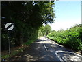
Residents of SG12 8XB enjoy practical access to essential amenities within a short distance. Five notable retail outlets operate nearby, including Co-op Stanstead, Morrisons Daily, and Tesco Hoddesdon. These stores provide comprehensive provisions for groceries, household necessities, and daily shopping needs. You can fill your fridge and pantry without driving far beyond the immediate neighbourhood. The area also benefits from five rail stations within easy reach, including St Margarets Railway Station, Roydon Railway Station, and Rye House Railway Station. These rail links connect you to broader transport networks for commuting or leisure travel. Travel times to larger cities remain manageable thanks to these station options. Local shops reduce the need for frequent trips to distant supermarkets or high streets. The availability of multiple rail stations offers flexibility for catching earlier morning trains or later evening departures. Retail variety ensures you can find specific brands or international foods close to home. Convenience stores complement larger supermarkets for quick top-ups before heading out. The presence of multiple transport hubs and shops creates a self-sufficient lifestyle core. You can manage daily errands in one afternoon if required. These amenities support both active commuters and those who prefer local shopping. The proximity of these services enhances the livability of this small residential cluster. No major entertainment venues are listed, but transport and retail fulfill core lifestyle requirements.
Amenities
Schools
Families living in SG12 8XB have access to specific educational institutions within practical reach. St Andrew's Church of England Voluntary Controlled Primary School serves young children in the region with an Ofsted rating of Good. This positive rating confirms the school meets the expected standards for primary education. The school provides a foundation for local children to begin their educational journey. Warrax House School also operates nearby, serving as a special needs institution for pupils with specific educational requirements. The presence of a special school indicates commitment to inclusive education within the local cluster. While secondary schools are not listed in the provided data, these two institutions cover the early years of learning. The mix of a village primary and a special needs provision suggests diverse educational pathways for residents. Parents considering schools near SG12 8XB will find at least one rated Good option for primary-aged children. The proximity of Warrax House School ensures vulnerable students can access care without travelling far. Transport links support families who need to escort children to lessons or attend meetings with teachers. The combination of mainstream and special education facilities creates a supportive environment for all learners. Parents appreciate knowing that residential area supports early education quality. Access to a Ofsted-rated school adds value to the local housing market. The data does not list secondary options, so prospective buyers should research further beyond the immediate school catchment. These names represent the only verified academic settings in the vicinity.
| Rank | School | Type | Entry gender | Ages |
|---|---|---|---|---|
| 1 | St Andrew's Church of England Voluntary Controlled Primary School | primary | N/A | N/A |
| 2 | Warrax House School | special | N/A | N/A |
Explore more schools in this area
Go to Schools tabDemographics
The community in SG12 8XB reflects a mature resident base with a median age of 47 years. Adults aged between 30 and 64 years form the most common age range within the population. You are likely to encounter established households rather than young students or transient workers, given the demographic profile. Home ownership stands at 60 per cent, indicating strong stability within the neighbourhood. The predominant accommodation type consists of houses, suggesting a family-oriented environment with more space than flat-dominated zones. The predominant ethnic group is White, which aligns with broader trends in many parts of the local district. These figures point to an area where long-term families reside in single-family homes. The high home ownership rate means mortgage holders have a vested interest in maintaining property values. You will find fewer empty rental properties compared to areas with lower ownership percentages. The age profile suggests that services catering to adults and families are most relevant here. Seniors are present due to the median age, while younger families complete the household mix. This demographic structure supports local demand for amenities relevant to working-age adults. The population density of 137 people per square kilometre ensures noise levels remain manageable. No commercial hubs dominate the streets; instead, residential streets prevail. This environment suits individuals who value privacy and reduced traffic congestion.
Household Size
Accommodation Type
Tenure
Ethnic Group
Religion
Household Composition
Age
Household Deprivation
NS-SEC
Explore more demographic insights in this area
Go to Demographics tabPlanning
Planning Constraints
- Flood RiskPremium
- Ramsar Wetland SitesPremium
- Area of Outstanding Natural BeautyPremium
- Protected Nature ReservePremium
- Protected WoodlandPremium
- Crime RiskPremium