Area Overview for SG12 8TA
Photos of SG12 8TA
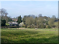
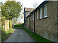
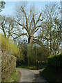
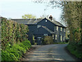
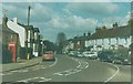
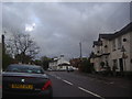
10 photos from this area
Area Information
Key information about the SG12 8TA including its size, population, and administrative classification.
- Area Type
- Postcode
- Area Size
- 8.1 hectares
- Population
- 2205
- Population Density
- 122 people/km²
House Prices in SG12 8TA
6
Properties
£602,500
Average Sold Price
£580,000
Lowest Price
£625,000
Highest Price
Showing 6 properties
| Address | Type | Beds | Baths | Last Sale Price | Last Sale Date | |
|---|---|---|---|---|---|---|
| Plovers, Medcalf Hill, Widford, SG12 8TA | Detached | 5 | 3 | £580,000 | Jul 2016 | |
| Hadham End, Medcalf Hill, Widford, SG12 8TA | Detached | 5 | 3 | £625,000 | Nov 2009 | |
| The Bungalow, Howletts Road, Widford, SG12 8TA | Bungalow | 2 | 1 | - | - | |
| 2 Medcalf Hill, Widford, SG12 8TA | Detached | 3 | 1 | - | - | |
| 1 Medcalf Hill, Widford, SG12 8TA | Detached | 4 | 2 | - | - | |
| Maple Tree Cottage, Medcalf Hill, Widford, SG12 8TA | house | - | - | - | - |
Energy Efficiency in SG12 8TA
Amenities
Schools
| Rank | School | Type | Entry gender | Ages |
|---|
Explore more schools in this area
Go to Schools tabDemographics
Household Size
Family (3-5 people)
most common
Accommodation Type
Houses
most common
Tenure
77
majority
Ethnic Group
White
most common
Religion
N/A
most common
Household Composition
N/A
most common
Age
47
median
Adults (30-64 years)
most common
Household Deprivation
N/A
with no deprivation
NS-SEC
44
in Lower managerial occupations
Explore more demographic insights in this area
Go to Demographics tabPlanning
Planning Constraints
- Flood RiskPremium
- Ramsar Wetland SitesPremium
- Area of Outstanding Natural BeautyPremium
- Protected Nature ReservePremium
- Protected WoodlandPremium