Area Overview for SG12 8DX
Photos of SG12 8DX
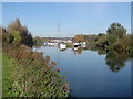
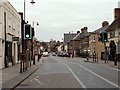

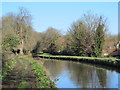
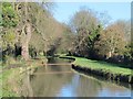
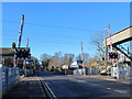

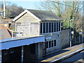
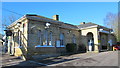
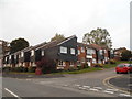
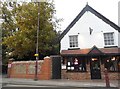
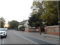
43 photos from this area
Area Information
Key information about the SG12 8DX including its size, population, and administrative classification.
- Area Type
- Postcode
- Area Size
- 1.2 hectares
- Population
- 1467
- Population Density
- 820 people/km²
House Prices in SG12 8DX
20
Properties
£304,346
Average Sold Price
£112,000
Lowest Price
£580,000
Highest Price
Showing 20 properties
| Address | Type | Beds | Baths | Last Sale Price | Last Sale Date | |
|---|---|---|---|---|---|---|
| River View, 24 Amwell Lane, Stanstead Abbotts, SG12 8DX | Bungalow | 3 | 1 | £575,000 | Dec 2024 | |
| 3 The Nook, Great Amwell, SG12 8DX | Flat | 1 | 1 | £215,000 | Nov 2016 | |
| Naiad, 6 Amwell Lane, Stanstead Abbotts, SG12 8DX | Bungalow | 2 | 1 | £440,000 | Jun 2016 | |
| Lynton, 16 Amwell Lane, Stanstead Abbotts, SG12 8DX | Bungalow | 4 | - | £580,000 | Aug 2014 | |
| The Lodge, 12 Amwell Lane, Stanstead Abbotts, SG12 8DX | Bungalow | 4 | 1 | £210,000 | Sep 2013 | |
| 2 Amwell Lane, Stanstead Abbotts, SG12 8DX | Detached | 3 | 2 | £425,000 | Apr 2011 | |
| Sunnyside, 10 Amwell Lane, Stanstead Abbotts, SG12 8DX | house | 4 | - | £220,000 | Dec 2008 | |
| Folly View, 30 Amwell Lane, Stanstead Abbotts, SG12 8DX | Detached | - | - | £360,000 | Jun 2007 | |
| Millhaven, 28 Amwell Lane, Stanstead Abbotts, SG12 8DX | Semi-detached | - | - | £308,000 | Jul 2006 | |
| BEECHVIEW, 14 AMWELL LANE, Stanstead Abbotts, SG12 8DX | Bungalow | 4 | 2 | £156,000 | Apr 2006 |
Page 1 of 2
Energy Efficiency in SG12 8DX
Amenities
Schools
| Rank | School | Type | Entry gender | Ages |
|---|
Explore more schools in this area
Go to Schools tabDemographics
Household Size
Family (3-5 people)
most common
Accommodation Type
Houses
most common
Tenure
63
majority
Ethnic Group
White
most common
Religion
N/A
most common
Household Composition
N/A
most common
Age
47
median
Adults (30-64 years)
most common
Household Deprivation
N/A
with no deprivation
NS-SEC
32
in Lower managerial occupations
Explore more demographic insights in this area
Go to Demographics tabPlanning
Planning Constraints
- Flood RiskPremium
- Ramsar Wetland SitesPremium
- Area of Outstanding Natural BeautyPremium
- Protected Nature ReservePremium
- Protected WoodlandPremium