Area Overview for SG12 7QE
Photos of SG12 7QE
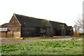
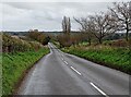
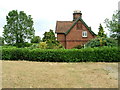
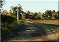
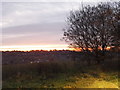
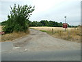
8 photos from this area
Area Information
Key information about the SG12 7QE including its size, population, and administrative classification.
- Area Type
- Postcode
- Area Size
- 30.1 hectares
- Population
- 1505
- Population Density
- 2966 people/km²
House Prices in SG12 7QE
16
Properties
£885,000
Average Sold Price
£885,000
Lowest Price
£885,000
Highest Price
Showing 16 properties
| Address | Type | Beds | Baths | Last Sale Price | Last Sale Date | |
|---|---|---|---|---|---|---|
| Widbury House, Widbury Hill, Ware, SG12 7QE | Semi-detached | 4 | - | £885,000 | Mar 2000 | |
| The Coach House, 2 Widbury House, Widbury Hill, Ware, SG12 7QE | Detached | 4 | 3 | - | - | |
| The Lodge, 1 Widbury House, Widbury Hill, Ware, SG12 7QE | Detached | 3 | 1 | - | - | |
| 3, Grays, Widbury House, Widbury Hill, Ware, SG12 7QE | Semi-detached | 4 | 2 | - | - | |
| 7, Tall Pines, Widbury House, Widbury Hill, Ware, SG12 7QE | Detached | 4 | 3 | - | - | |
| 6, Tara, Widbury House, Widbury Hill, Ware, SG12 7QE | Retail | 4 | 2 | - | - | |
| 8, Arches, Widbury House, Widbury Hill, Ware, SG12 7QE | Semi-detached | 5 | - | - | - | |
| 9, Widbury House, Widbury Hill, Ware, SG12 7QE | Semi-detached | - | - | - | - | |
| 4, The Hollies, Widbury House, Widbury Hill, Ware, SG12 7QE | Semi-detached | - | - | - | - | |
| Warner & Co Accountants, First Floor Front The Extension, Widbury Barns, Widbury Hill, Ware, SG12 7QE | Office | - | - | - | - |
Page 1 of 2
Energy Efficiency in SG12 7QE
Amenities
Schools
| Rank | School | Type | Entry gender | Ages |
|---|
Explore more schools in this area
Go to Schools tabDemographics
Household Size
Family (3-5 people)
most common
Accommodation Type
Houses
most common
Tenure
68
majority
Ethnic Group
White
most common
Religion
N/A
most common
Household Composition
N/A
most common
Age
47
median
Adults (30-64 years)
most common
Household Deprivation
N/A
with no deprivation
NS-SEC
34
in Lower managerial occupations
Explore more demographic insights in this area
Go to Demographics tabPlanning
Planning Constraints
- Flood RiskPremium
- Ramsar Wetland SitesPremium
- Area of Outstanding Natural BeautyPremium
- Protected Nature ReservePremium
- Protected WoodlandPremium