Area Overview for SG12 7EJ
Photos of SG12 7EJ
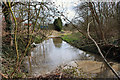
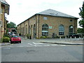
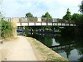
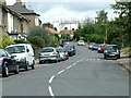
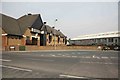
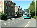
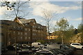
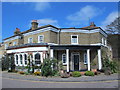
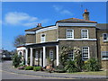

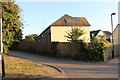
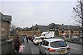
62 photos from this area
Area Information
Key information about the SG12 7EJ including its size, population, and administrative classification.
- Area Type
- Postcode
- Area Size
- 2.2 hectares
- Population
- 2071
- Population Density
- 2838 people/km²
House Prices in SG12 7EJ
41
Properties
£358,543
Average Sold Price
£82,000
Lowest Price
£781,250
Highest Price
Showing 41 properties
| Address | Type | Beds | Baths | Last Sale Price | Last Sale Date | |
|---|---|---|---|---|---|---|
| 41 King Edwards Road, Ware, SG12 7EJ | Semi-detached | 3 | 2 | £638,500 | Dec 2023 | |
| 48 King Edwards Road, Ware, SG12 7EJ | Terraced | 3 | 1 | £445,000 | Mar 2023 | |
| 34 King Edwards Road, Ware, SG12 7EJ | Detached | 3 | 3 | £781,250 | Jul 2022 | |
| 32 King Edwards Road, Ware, SG12 7EJ | Semi-detached | 4 | 2 | £461,000 | Feb 2019 | |
| 36 King Edwards Road, Ware, SG12 7EJ | Detached | 3 | 2 | £570,000 | Aug 2018 | |
| 25 King Edwards Road, Ware, SG12 7EJ | house | - | - | £755,000 | Mar 2018 | |
| 29 King Edwards Road, Ware, SG12 7EJ | Detached | 4 | 1 | £690,000 | Jul 2017 | |
| 23 King Edwards Road, Ware, SG12 7EJ | house | - | - | £550,000 | Feb 2015 | |
| 53 King Edwards Road, Ware, SG12 7EJ | house | - | - | £392,000 | Dec 2014 | |
| 18 King Edwards Road, Ware, SG12 7EJ | Detached | 4 | - | £440,000 | Apr 2013 |
Page 1 of 5
Energy Efficiency in SG12 7EJ
Amenities
Schools
| Rank | School | Type | Entry gender | Ages |
|---|
Explore more schools in this area
Go to Schools tabDemographics
Household Size
Two person
most common
Accommodation Type
Houses
most common
Tenure
71
majority
Ethnic Group
White
most common
Religion
N/A
most common
Household Composition
N/A
most common
Age
47
median
Adults (30-64 years)
most common
Household Deprivation
N/A
with no deprivation
NS-SEC
50
in Lower managerial occupations
Explore more demographic insights in this area
Go to Demographics tabPlanning
Planning Constraints
- Flood RiskPremium
- Ramsar Wetland SitesPremium
- Area of Outstanding Natural BeautyPremium
- Protected Nature ReservePremium
- Protected WoodlandPremium