Area Overview for SG12 0SY
Photos of SG12 0SY
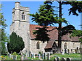
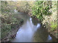
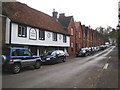

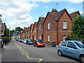
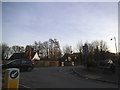
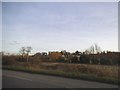
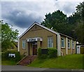
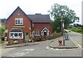
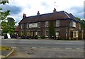
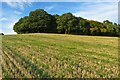
27 photos from this area
Area Information
Key information about the SG12 0SY including its size, population, and administrative classification.
- Area Type
- Postcode
- Area Size
- 2.9 hectares
- Population
- 1573
- Population Density
- 100 people/km²
House Prices in SG12 0SY
41
Properties
£482,173
Average Sold Price
£120,000
Lowest Price
£1,587,500
Highest Price
Showing 41 properties
| Address | Type | Beds | Baths | Last Sale Price | Last Sale Date | |
|---|---|---|---|---|---|---|
| 40 Ermine Street, Thundridge, SG12 0SY | Terraced | 2 | 1 | £493,000 | Oct 2025 | |
| 19 Ermine Street, Thundridge, SG12 0SY | Terraced | 2 | 1 | £350,000 | Jul 2024 | |
| 28 Ermine Street, Thundridge, SG12 0SY | house | 5 | 1 | £637,500 | Jun 2023 | |
| 31 Ermine Street, Thundridge, SG12 0SY | Character Property | 4 | 3 | £1,587,500 | Jun 2021 | |
| 16 Ermine Street, Thundridge, SG12 0SY | Semi-detached | - | - | £427,000 | Mar 2021 | |
| 11 Ermine Street, Thundridge, SG12 0SY | Semi-detached | 3 | 1 | £510,000 | Oct 2020 | |
| 58 Ermine Street, Thundridge, SG12 0SY | Terraced | 3 | 1 | £436,000 | Apr 2020 | |
| 48 Ermine Street, Thundridge, SG12 0SY | Terraced | 2 | 1 | £340,000 | Sep 2019 | |
| 32 Ermine Street, Thundridge, SG12 0SY | Cottage | 2 | - | £425,000 | Apr 2018 | |
| 14 Ermine Street, Thundridge, SG12 0SY | Semi-detached | - | - | £525,000 | Aug 2016 |
Page 1 of 5
Energy Efficiency in SG12 0SY
Amenities
Schools
| Rank | School | Type | Entry gender | Ages |
|---|
Explore more schools in this area
Go to Schools tabDemographics
Household Size
Family (3-5 people)
most common
Accommodation Type
Houses
most common
Tenure
75
majority
Ethnic Group
White
most common
Religion
N/A
most common
Household Composition
N/A
most common
Age
47
median
Adults (30-64 years)
most common
Household Deprivation
N/A
with no deprivation
NS-SEC
38
in Lower managerial occupations
Explore more demographic insights in this area
Go to Demographics tabPlanning
Planning Constraints
- Flood RiskPremium
- Ramsar Wetland SitesPremium
- Area of Outstanding Natural BeautyPremium
- Protected Nature ReservePremium
- Protected WoodlandPremium