Area Overview for SG12 0RJ
Photos of SG12 0RJ

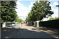

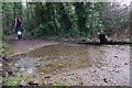
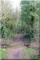
16 photos from this area
Area Information
Key information about the SG12 0RJ including its size, population, and administrative classification.
- Area Type
- Postcode
- Area Size
- 1.5 hectares
- Population
- 1619
- Population Density
- 4875 people/km²
House Prices in SG12 0RJ
34
Properties
£454,772
Average Sold Price
£134,995
Lowest Price
£725,000
Highest Price
Showing 34 properties
| Address | Type | Beds | Baths | Last Sale Price | Last Sale Date | |
|---|---|---|---|---|---|---|
| 73 Heath Drive, Ware, SG12 0RJ | house | - | - | £675,000 | Jun 2025 | |
| 66 Heath Drive, Ware, SG12 0RJ | Semi-detached | 4 | 2 | £725,000 | Feb 2025 | |
| 62 Heath Drive, Ware, SG12 0RJ | Semi-detached | 3 | 1 | £670,000 | Sep 2024 | |
| 75 Heath Drive, Ware, SG12 0RJ | house | - | - | £600,000 | Nov 2023 | |
| 74 Heath Drive, Ware, SG12 0RJ | house | - | - | £455,000 | Apr 2023 | |
| 76 Heath Drive, Ware, SG12 0RJ | Semi-detached | 3 | 1 | £539,000 | May 2022 | |
| 81 Heath Drive, Ware, SG12 0RJ | house | - | - | £635,000 | Sep 2021 | |
| 91 Heath Drive, Ware, SG12 0RJ | Semi-detached | 3 | 1 | £465,000 | Jun 2020 | |
| 65 Heath Drive, Ware, SG12 0RJ | house | - | - | £546,000 | Oct 2019 | |
| 69 Heath Drive, Ware, SG12 0RJ | Semi-detached | 3 | 1 | £525,000 | Jul 2019 |
Page 1 of 4
Energy Efficiency in SG12 0RJ
Amenities
Schools
| Rank | School | Type | Entry gender | Ages |
|---|
Explore more schools in this area
Go to Schools tabDemographics
Household Size
Family (3-5 people)
most common
Accommodation Type
Houses
most common
Tenure
85
majority
Ethnic Group
White
most common
Religion
N/A
most common
Household Composition
N/A
most common
Age
47
median
Adults (30-64 years)
most common
Household Deprivation
N/A
with no deprivation
NS-SEC
41
in Lower managerial occupations
Explore more demographic insights in this area
Go to Demographics tabPlanning
Planning Constraints
- Flood RiskPremium
- Ramsar Wetland SitesPremium
- Area of Outstanding Natural BeautyPremium
- Protected Nature ReservePremium
- Protected WoodlandPremium