Area Overview for SG12 0QS
Photos of SG12 0QS
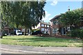
16 photos from this area
Area Information
Key information about the SG12 0QS including its size, population, and administrative classification.
- Area Type
- Postcode
- Area Size
- 1668 m²
- Population
- 1619
- Population Density
- 4875 people/km²
House Prices in SG12 0QS
8
Properties
£224,938
Average Sold Price
£63,000
Lowest Price
£307,500
Highest Price
Showing 8 properties
| Address | Type | Beds | Baths | Last Sale Price | Last Sale Date | |
|---|---|---|---|---|---|---|
| 1 Kingsway, Ware, SG12 0QS | Maisonette | 2 | 1 | £300,000 | Feb 2023 | |
| 3 Kingsway, Ware, SG12 0QS | Maisonette | - | - | £307,500 | Feb 2023 | |
| 1A Kingsway, Ware, SG12 0QS | Maisonette | - | - | £255,000 | Oct 2020 | |
| 3A Kingsway, Ware, SG12 0QS | Maisonette | 2 | 1 | £278,500 | Oct 2018 | |
| 7 Kingsway, Ware, SG12 0QS | Flat | 2 | 1 | £307,500 | May 2017 | |
| 7A Kingsway, Ware, SG12 0QS | Flat | - | - | £149,000 | Sep 2011 | |
| 5A Kingsway, Ware, SG12 0QS | Flat | - | - | £139,000 | Oct 2003 | |
| 5 Kingsway, Ware, SG12 0QS | Flat | - | - | £63,000 | Jun 1998 |
Energy Efficiency in SG12 0QS
Amenities
Schools
| Rank | School | Type | Entry gender | Ages |
|---|
Explore more schools in this area
Go to Schools tabDemographics
Household Size
Family (3-5 people)
most common
Accommodation Type
Houses
most common
Tenure
85
majority
Ethnic Group
White
most common
Religion
N/A
most common
Household Composition
N/A
most common
Age
47
median
Adults (30-64 years)
most common
Household Deprivation
N/A
with no deprivation
NS-SEC
41
in Lower managerial occupations
Explore more demographic insights in this area
Go to Demographics tabPlanning
Planning Constraints
- Flood RiskPremium
- Ramsar Wetland SitesPremium
- Area of Outstanding Natural BeautyPremium
- Protected Nature ReservePremium
- Protected WoodlandPremium