Area Overview for SG12 0DT
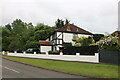
Photos of SG12 0DT


Area Information
The postcode SG12 0DT defines a specific residential cluster covering 21.1 hectares of land in England. You are looking at a defined area housing 1,419 residents, resulting in a population density of 366 people per square kilometre. This neighbourhood operates as a self-contained community rather than a large urban sprawl. The low density suggests a quiet environment where homes are spaced further apart compared to town centres. Living in SG12 0DT means navigating a small, manageable zone where residents likely know their neighbours. The area functions as a distinct pocket of housing within a broader local authority jurisdiction. Daily life here revolves around proximity to rail hubs and local retail parks rather than a dense street grid. The geography is contained enough to allow for straightforward walking to nearby services. You will find this postcode serves as a gateway to the wider Watford and Hertfordshire corridor. The scale of the area ensures that community matters remain relevant without the anonymity of larger cities.
- Area Type
- Postcode
- Area Size
- 21.1 hectares
- Population
- 1419
- Population Density
- 366 people/km²
The housing market in SG12 0DT centres on a stock that is overwhelmingly owner-occupied. With 86% of properties in this postcode owned by residents, you are buying into a stable environment. The predominant accommodation type listed for the area is houses. This means your search will largely focus on family homes rather than flats or modern developments. The high ownership rate suggests strong property values and local investment. Buyers looking at homes in SG12 0DT should expect to enter an established market. The area does not feature a high volume of tenanted properties or student housing blocks. This characteristic makes the neighbourhood attractive for families seeking permanence. The limited number of units in this 21.1-hectare cluster means competition can be specific and intense for the right address. There is no shortage of property types available since the stock is primarily houses. Your expectations regarding rental yields versus acquisition costs should be based on this ownership reality. The market reflects a community that values property as an asset to hold and maintain long-term.
House Prices in SG12 0DT
Showing 2 properties
| Address | Type | Beds | Baths | Last Sale Price | Last Sale Date | |
|---|---|---|---|---|---|---|
| Guest House Annexe, Carmelite Monastery, Unadopted Track West From Ware Road To Greenacres, Ware Park, Ware, SG12 0DT | house | - | - | - | - | |
| Carmelite Monastery, Unadopted Track West From Ware Road To Greenacres, Ware Park, Ware, SG12 0DT | house | - | - | - | - |
Energy Efficiency in SG12 0DT
Your daily lifestyle in SG12 0DT benefits from a network of practical amenities within reach. Five retail outlets operate nearby, including Asda Ware, M&S Rush Green BP, and Tesco Ware. These venues provide comprehensive shopping needs from groceries to clothing. The presence of Tesco Ware ensures fresh food accessibility without requiring long drives. Public transport links via Ware, Hertford East, and Hertford North Railway Stations offer five distinct rail journey options. You can leave your car at home for most daily commutes. The concentration of supermarkets and banks like M&S signals a service-oriented environment. Dining and leisure options befit a residential cluster focused on convenience over nightlife. The area caters to needs rather than providing entertainment districts. Living in SG12 0DT balances suburban convenience with the quietness of a low-density location. The specific venues named confirm that essential services are immediately available. You will not need to travel far for routine household requirements.
Amenities
Schools
Families in SG12 0DT have access to Duncombe School as the primary educational institution in the immediate vicinity. This is an independent school holding a 'good' Ofsted rating. The existence of an independent option alongside maintained schools indicates a mature local education sector. You may find this mix supports specific educational preferences or financial flexibility for parents. Duncombe School offers a private education path for children residing near the postcode. No other schools were recorded in the provided data for this specific area. This limitation does not diminish the quality of the available institution but rather highlights the specificity of the options nearby. The presence of a 'good' rated school is a positive indicator for family planning. Schools near SG12 0DT provide a regulated standard of education consistent with national requirements. Parents considering this location can rely on the established reputation of Duncombe School. The independent nature of the facility suggests a different ethos compared to state-funded options.
| Rank | School | Type | Entry gender | Ages |
|---|
Explore more schools in this area
Go to Schools tabDemographics
You are entering a community characterised by stability and established residency. Eighty-six per cent of households in SG12 0DT own their property outright or with a mortgage. This significant ownership rate indicates a settled population rather than a transient rental market. The predominant accommodation type consists of houses, not flats or apartments. This housing stock attracts families and individuals seeking standalone or semi-detected properties. The most common age range for residents falls between 30 and 64 years, reflecting working-age adults and mature families. The median age is 47, which aligns with this predominantly adult demographic. White ethnicity forms the predominant group within this neighbourhood. The demographic profile suggests a traditional family structure. You will find few very young children or elderly singles dominating the statistics, though these groups certainly reside here. The high home ownership figure often correlates with long-term commitment to an address. This demographic mix creates a predictable and steady local dynamic for residents in SG12 0DT.
Household Size
Accommodation Type
Tenure
Ethnic Group
Religion
Household Composition
Age
Household Deprivation
NS-SEC
Explore more demographic insights in this area
Go to Demographics tabPlanning
Planning Constraints
- Flood RiskPremium
- Ramsar Wetland SitesPremium
- Area of Outstanding Natural BeautyPremium
- Protected Nature ReservePremium
- Protected WoodlandPremium