Area Overview for SG12 0BE
Photos of SG12 0BE
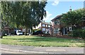
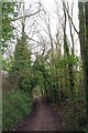
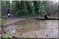
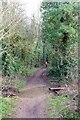
16 photos from this area
Area Information
Key information about the SG12 0BE including its size, population, and administrative classification.
- Area Type
- Postcode
- Area Size
- 6375 m²
- Population
- 1541
- Population Density
- 3350 people/km²
House Prices in SG12 0BE
12
Properties
£192,799
Average Sold Price
£67,500
Lowest Price
£269,995
Highest Price
Showing 12 properties
| Address | Type | Beds | Baths | Last Sale Price | Last Sale Date | |
|---|---|---|---|---|---|---|
| 59 Lower Bourne Gardens, Ware, SG12 0BE | house | - | - | £250,000 | Jul 2013 | |
| 61 Lower Bourne Gardens, Ware, SG12 0BE | Semi-detached | - | - | £269,995 | Feb 2007 | |
| 63 Lower Bourne Gardens, Ware, SG12 0BE | Semi-detached | - | - | £227,500 | Jul 2003 | |
| 57 Lower Bourne Gardens, Ware, SG12 0BE | Semi-detached | - | - | £149,000 | May 2001 | |
| 51 Lower Bourne Gardens, Ware, SG12 0BE | Semi-detached | - | - | £67,500 | Aug 1995 | |
| 47 Lower Bourne Gardens, Ware, SG12 0BE | Semi-detached | - | - | - | - | |
| 45 Lower Bourne Gardens, Ware, SG12 0BE | Semi-detached | - | - | - | - | |
| 53 Lower Bourne Gardens, Ware, SG12 0BE | Semi-detached | - | - | - | - | |
| 49 Lower Bourne Gardens, Ware, SG12 0BE | Semi-detached | - | - | - | - | |
| 55 Lower Bourne Gardens, Ware, SG12 0BE | Semi-detached | - | - | - | - |
Page 1 of 2
Energy Efficiency in SG12 0BE
Amenities
Schools
| Rank | School | Type | Entry gender | Ages |
|---|
Explore more schools in this area
Go to Schools tabDemographics
Household Size
Two person
most common
Accommodation Type
Houses
most common
Tenure
67
majority
Ethnic Group
White
most common
Religion
N/A
most common
Household Composition
N/A
most common
Age
47
median
Adults (30-64 years)
most common
Household Deprivation
N/A
with no deprivation
NS-SEC
39
in Lower managerial occupations
Explore more demographic insights in this area
Go to Demographics tabPlanning
Planning Constraints
- Flood RiskPremium
- Ramsar Wetland SitesPremium
- Area of Outstanding Natural BeautyPremium
- Protected Nature ReservePremium
- Protected WoodlandPremium