Area Overview for SG11 1BP
Photos of SG11 1BP

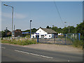

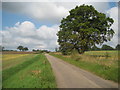
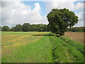

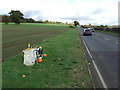
13 photos from this area
Area Information
Key information about the SG11 1BP including its size, population, and administrative classification.
- Area Type
- Postcode
- Area Size
- 34.1 hectares
- Population
- 1573
- Population Density
- 100 people/km²
House Prices in SG11 1BP
12
Properties
£606,500
Average Sold Price
£194,500
Lowest Price
£845,000
Highest Price
Showing 12 properties
| Address | Type | Beds | Baths | Last Sale Price | Last Sale Date | |
|---|---|---|---|---|---|---|
| The Barnhouse, Standon Green End, High Cross, SG11 1BP | Detached | 3 | 1 | £845,000 | Jan 2023 | |
| Oakwood House, Standon Green End, High Cross, SG11 1BP | house | 5 | - | £780,000 | Nov 2005 | |
| 2, New Cottages, Standon Green End, High Cross, SG11 1BP | Semi-detached | - | - | £194,500 | Oct 1997 | |
| The New House, Standon Green End, High Cross, SG11 1BP | Detached | 3 | - | - | - | |
| The Annexe, The New House, Standon Green End, High Cross, SG11 1BP | Maisonette | - | - | - | - | |
| Cherry Hinton, Standon Green End, High Cross, SG11 1BP | Detached | - | - | - | - | |
| Knoll House, Standon Green End, High Cross, SG11 1BP | Detached | - | - | - | - | |
| Knoll Farm, Standon Green End, High Cross, SG11 1BP | Detached | - | - | - | - | |
| Motts Spring Farm, Standon Green End, High Cross, SG11 1BP | Detached | - | - | - | - | |
| Beechcroft, Standon Green End, High Cross, SG11 1BP | Flat | 1 | 1 | - | - |
Page 1 of 2
Energy Efficiency in SG11 1BP
Amenities
Schools
| Rank | School | Type | Entry gender | Ages |
|---|
Explore more schools in this area
Go to Schools tabDemographics
Household Size
Family (3-5 people)
most common
Accommodation Type
Houses
most common
Tenure
75
majority
Ethnic Group
White
most common
Religion
N/A
most common
Household Composition
N/A
most common
Age
47
median
Adults (30-64 years)
most common
Household Deprivation
N/A
with no deprivation
NS-SEC
38
in Lower managerial occupations
Explore more demographic insights in this area
Go to Demographics tabPlanning
Planning Constraints
- Flood RiskPremium
- Ramsar Wetland SitesPremium
- Area of Outstanding Natural BeautyPremium
- Protected Nature ReservePremium
- Protected WoodlandPremium