Area Overview for SG10 6BU
Photos of SG10 6BU
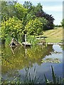
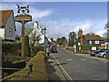
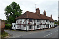
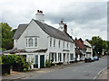
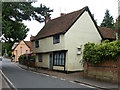
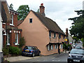
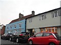
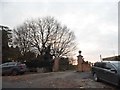
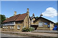
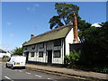
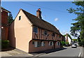
46 photos from this area
Area Information
Key information about the SG10 6BU including its size, population, and administrative classification.
- Area Type
- Postcode
- Area Size
- 4.0 hectares
- Population
- 1680
- Population Density
- 138 people/km²
House Prices in SG10 6BU
9
Properties
£704,917
Average Sold Price
£499,500
Lowest Price
£915,000
Highest Price
Showing 9 properties
| Address | Type | Beds | Baths | Last Sale Price | Last Sale Date | |
|---|---|---|---|---|---|---|
| 55 High Street, Much Hadham, SG10 6BU | Detached | 4 | 2 | £815,000 | Apr 2025 | |
| Russetts, 54 High Street, Much Hadham, SG10 6BU | Cottage | 3 | 2 | £515,000 | Feb 2020 | |
| Collarmakers House, 49 High Street, Much Hadham, SG10 6BU | house | 4 | - | £835,000 | Sep 2017 | |
| Chancery Cottage, 52 High Street, Much Hadham, SG10 6BU | Detached | 5 | 3 | £650,000 | Jun 2014 | |
| Red House, High Street, Much Hadham, SG10 6BU | house | - | - | £915,000 | Sep 2010 | |
| Red Cottage, High Street, Much Hadham, SG10 6BU | Detached | - | - | £499,500 | Apr 2008 | |
| Hopleys, High Street, Much Hadham, SG10 6BU | Detached | 3 | 3 | - | - | |
| 50 High Street, Much Hadham, SG10 6BU | Retail | 3 | 3 | - | - | |
| Managers Flat, The Bull Inn, High Street, Much Hadham, SG10 6BU | Flat | - | - | - | - |
Energy Efficiency in SG10 6BU
Amenities
Schools
| Rank | School | Type | Entry gender | Ages |
|---|
Explore more schools in this area
Go to Schools tabDemographics
Household Size
Two person
most common
Accommodation Type
Houses
most common
Tenure
71
majority
Ethnic Group
White
most common
Religion
N/A
most common
Household Composition
N/A
most common
Age
47
median
Adults (30-64 years)
most common
Household Deprivation
N/A
with no deprivation
NS-SEC
46
in Lower managerial occupations
Explore more demographic insights in this area
Go to Demographics tabPlanning
Planning Constraints
- Flood RiskPremium
- Ramsar Wetland SitesPremium
- Area of Outstanding Natural BeautyPremium
- Protected Nature ReservePremium
- Protected WoodlandPremium