Area Overview for SG1 5TH
Photos of SG1 5TH
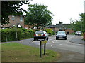
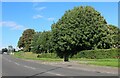
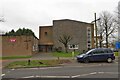


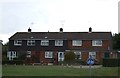


11 photos from this area
Area Information
Key information about the SG1 5TH including its size, population, and administrative classification.
- Area Type
- Postcode
- Area Size
- 5631 m²
- Population
- 1614
- Population Density
- 5742 people/km²
House Prices in SG1 5TH
24
Properties
£190,972
Average Sold Price
£19,000
Lowest Price
£318,000
Highest Price
Showing 24 properties
| Address | Type | Beds | Baths | Last Sale Price | Last Sale Date | |
|---|---|---|---|---|---|---|
| 90 Derby Way, Stevenage, SG1 5TH | Flat | 1 | 1 | £115,000 | Nov 2025 | |
| 72 Derby Way, Stevenage, SG1 5TH | Terraced | 2 | 1 | £318,000 | Oct 2024 | |
| 73 Derby Way, Stevenage, SG1 5TH | Terraced | 2 | 1 | £307,500 | Jun 2024 | |
| 87 Derby Way, Stevenage, SG1 5TH | Flat | - | - | £127,000 | Jun 2022 | |
| 94 Derby Way, Stevenage, SG1 5TH | house | 3 | 2 | £265,000 | Mar 2021 | |
| 80 Derby Way, Stevenage, SG1 5TH | house | - | - | £300,000 | Apr 2020 | |
| 89 Derby Way, Stevenage, SG1 5TH | Flat | - | - | £140,000 | Mar 2020 | |
| 79 Derby Way, Stevenage, SG1 5TH | house | 3 | - | £290,000 | Jan 2019 | |
| 81 Derby Way, Stevenage, SG1 5TH | Terraced | 3 | 1 | £295,000 | Nov 2018 | |
| 93 Derby Way, Stevenage, SG1 5TH | Terraced | 4 | - | £300,000 | Jun 2017 |
Page 1 of 3
Energy Efficiency in SG1 5TH
Amenities
Schools
| Rank | School | Type | Entry gender | Ages |
|---|
Explore more schools in this area
Go to Schools tabDemographics
Household Size
Two person
most common
Accommodation Type
Houses
most common
Tenure
68
majority
Ethnic Group
White
most common
Religion
N/A
most common
Household Composition
N/A
most common
Age
47
median
Adults (30-64 years)
most common
Household Deprivation
N/A
with no deprivation
NS-SEC
36
in Lower managerial occupations
Explore more demographic insights in this area
Go to Demographics tabPlanning
Planning Constraints
- Flood RiskPremium
- Ramsar Wetland SitesPremium
- Area of Outstanding Natural BeautyPremium
- Protected Nature ReservePremium
- Protected WoodlandPremium