Area Overview for SG1 5RZ
Photos of SG1 5RZ
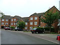
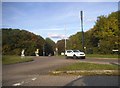
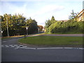
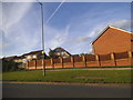
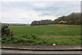
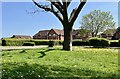
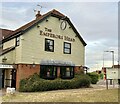
28 photos from this area
Area Information
Key information about the SG1 5RZ including its size, population, and administrative classification.
- Area Type
- Postcode
- Area Size
- 3.2 hectares
- Population
- 1341
- Population Density
- 6329 people/km²
House Prices in SG1 5RZ
85
Properties
£268,098
Average Sold Price
£79,950
Lowest Price
£585,000
Highest Price
Showing 85 properties
| Address | Type | Beds | Baths | Last Sale Price | Last Sale Date | |
|---|---|---|---|---|---|---|
| 69 Ayr Close, Stevenage, SG1 5RZ | Detached | 3 | 2 | £460,000 | Jun 2025 | |
| 71 Ayr Close, Stevenage, SG1 5RZ | Detached | 5 | 3 | £585,000 | May 2025 | |
| 80 Ayr Close, Stevenage, SG1 5RZ | Semi-detached | 3 | 2 | £413,000 | Mar 2025 | |
| 82 Ayr Close, Stevenage, SG1 5RZ | Terraced | 3 | 2 | £400,000 | May 2024 | |
| 49 Ayr Close, Stevenage, SG1 5RZ | house | - | - | £570,000 | Nov 2023 | |
| 27 Ayr Close, Stevenage, SG1 5RZ | Retail | 3 | 2 | £550,000 | Nov 2022 | |
| 43 Ayr Close, Stevenage, SG1 5RZ | Retail | 3 | 1 | £402,000 | Mar 2022 | |
| 46 Ayr Close, Stevenage, SG1 5RZ | Detached | 3 | 2 | £470,000 | Dec 2021 | |
| 48 Ayr Close, Stevenage, SG1 5RZ | Detached | 4 | 2 | £480,000 | Jun 2021 | |
| 13 Ayr Close, Stevenage, SG1 5RZ | Detached | 4 | 2 | £582,500 | Feb 2021 |
Page 1 of 9
Energy Efficiency in SG1 5RZ
Amenities
Schools
| Rank | School | Type | Entry gender | Ages |
|---|
Explore more schools in this area
Go to Schools tabDemographics
Household Size
Family (3-5 people)
most common
Accommodation Type
Houses
most common
Tenure
48
majority
Ethnic Group
White
most common
Religion
N/A
most common
Household Composition
N/A
most common
Age
47
median
Adults (30-64 years)
most common
Household Deprivation
N/A
with no deprivation
NS-SEC
30
in Lower managerial occupations
Explore more demographic insights in this area
Go to Demographics tabPlanning
Planning Constraints
- Flood RiskPremium
- Ramsar Wetland SitesPremium
- Area of Outstanding Natural BeautyPremium
- Protected Nature ReservePremium
- Protected WoodlandPremium