Area Overview for SG1 5RE
Photos of SG1 5RE
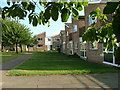
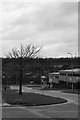
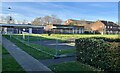
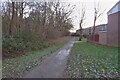
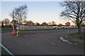
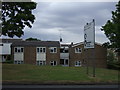
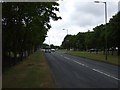
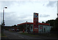
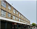
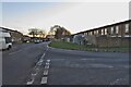
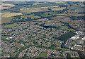
13 photos from this area
Area Information
Key information about the SG1 5RE including its size, population, and administrative classification.
- Area Type
- Postcode
- Area Size
- 3.1 hectares
- Population
- 1683
- Population Density
- 6551 people/km²
House Prices in SG1 5RE
75
Properties
£149,605
Average Sold Price
£9,000
Lowest Price
£282,500
Highest Price
Showing 75 properties
| Address | Type | Beds | Baths | Last Sale Price | Last Sale Date | |
|---|---|---|---|---|---|---|
| 2 Bradman Way, Stevenage, SG1 5RE | Bungalow | 2 | 1 | £260,000 | Mar 2025 | |
| 1 Bradman Way, Stevenage, SG1 5RE | Terraced | 2 | 1 | £280,000 | Mar 2025 | |
| 8 Bradman Way, Stevenage, SG1 5RE | Semi-detached | 1 | 1 | £180,000 | Mar 2025 | |
| 31 Bradman Way, Stevenage, SG1 5RE | Terraced | 1 | 1 | £195,000 | Oct 2024 | |
| 33 Bradman Way, Stevenage, SG1 5RE | Flat | - | - | £165,500 | Jul 2024 | |
| 9 Bradman Way, Stevenage, SG1 5RE | Terraced | 2 | - | £263,000 | Feb 2024 | |
| 3 Bradman Way, Stevenage, SG1 5RE | Terraced | 2 | - | £267,000 | Jan 2024 | |
| 58 Bradman Way, Stevenage, SG1 5RE | Flat | - | 1 | £123,500 | Aug 2023 | |
| 4 Bradman Way, Stevenage, SG1 5RE | Bungalow | 2 | 1 | £282,500 | Jun 2023 | |
| 12 Bradman Way, Stevenage, SG1 5RE | Semi-detached | 1 | 1 | £240,000 | Jun 2023 |
Page 1 of 8
Energy Efficiency in SG1 5RE
Amenities
Schools
| Rank | School | Type | Entry gender | Ages |
|---|
Explore more schools in this area
Go to Schools tabDemographics
Household Size
One person
most common
Accommodation Type
Houses
most common
Tenure
52
majority
Ethnic Group
White
most common
Religion
N/A
most common
Household Composition
N/A
most common
Age
47
median
Adults (30-64 years)
most common
Household Deprivation
N/A
with no deprivation
NS-SEC
27
in Lower managerial occupations
Explore more demographic insights in this area
Go to Demographics tabPlanning
Planning Constraints
- Flood RiskPremium
- Ramsar Wetland SitesPremium
- Area of Outstanding Natural BeautyPremium
- Protected Nature ReservePremium
- Protected WoodlandPremium