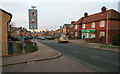
Area Overview for SG1 5QZ
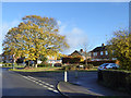
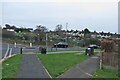
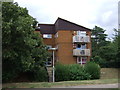
Photos of SG1 5QZ


Area Information
Living in SG1 5QZ offers a distinct residential experience within a specific postcode cluster in Stevenage. This small residential cluster has a total population of 1,915 residents, creating a close-knit environment where neighbours often know one another by sight. The area sits away from the busiest commercial hubs but remains well-positioned for local travel. You will find a quiet setting that appeals to those seeking stability and a balanced pace of life rather than the energy of a dense city centre. The compact nature of this postcode means that daily needs are often within walking or short driving distance. Families and professionals alike value the straightforward layout and the lack of significant planning constraints that might otherwise restrict development or noise. The character of SG1 5QZ is defined by its dedicated housing focus. Unlike mixed-use zones where you might hear heavy traffic from retail parks or construction sites daily, this area maintains a primarily residential feel. The population concentration ensures that services remain accessible without the overcrowding found in larger urban districts. Prospective homebuyers looking for a settled community in England will find this postcode area fitting. The size of the community invites a sense of familiarity that larger postcodes often dilute. You can navigate this small residential cluster with ease, knowing exactly where schools, shops, and community centres are located relative to your home.
- Area Type
- Postcode
- Area Size
- Not available
- Population
- 1915
- Population Density
- 3742 people/km²
The property market in SG1 5QZ is characterised by a strong presence of single-family homes. Houses make up the predominant accommodation type available in this postcode area. This housing style suggests a preference for detached or semi-detached properties with gardens, appealing mostly to families and those working from home who value privacy. With 45% of residents owning their homes, a significant portion of the market consists of owner-occupiers rather than landlords or tenants. This ownership level often correlates with slower house price fluctuations and a more stable community investment. When you look at homes in SG1 5QZ, you primarily see structures designed for permanent living rather than short-term accommodation. The variety in housing stock compared to some denser urban areas is limited, but the quality of individual properties is generally high. Buyers looking today should consider the implications of the 45% ownership rate; many street divisions will feature residents with a long-term stake in maintaining their building's appearance and value. This environment tends to foster respect for neighbours and adherence to community standards regarding exterior maintenance. For investors or first-time buyers, the mix of houses offers a straightforward path without the complications often associated with flats or shared ownership schemes in cities. The limited density helps keep property values competitive while preserving a sense of exclusivity that larger developments lack. You will not find rows of identical townhouses here, but rather a collection of individual homes that may differ in age and style. This diversity adds character to SG1 5QZ while maintaining the integrity of the residential zone. The market reflects a clear demand for traditional housing forms that suit the local lifestyle.
House Prices in SG1 5QZ
No properties found in this postcode.
Energy Efficiency in SG1 5QZ
Daily life in SG1 5QZ revolves around a cluster of retail and rail amenities that serve the residential population effectively. Within practical reach, you have access to Co-op Stevenage, Morrisons Daily, and Tesco Stevenage, ensuring your grocery and shopping needs are met without extensive travel. These three notable venues form the core of the retail offering for the 1,915 residents living here. You can complete most household purchases locally, whether you require fresh produce, household essentials, or general groceries. Transport options further enhance your lifestyle convenience, with five railway stations easily accessible from your postcode. Stevenage Railway Station stands out as the most prominent, offering regular services that connect the area to wider networks. Knebworth Railway Station and Hitchin Railway Station provide alternative stops, giving you choice when planning journeys. This rail infrastructure means you are not isolated geographically despite the quiet residential nature of SG1 5QZ. The convenience of having supermarkets and rail links nearby defines the local character. You do not need to drive into town for basic tasks, saving time and reducing reliance on cars for daily trips. This balance of local shopping and transport access creates a comfortable routine for residents. The absence of overly commercialised areas means the neighbourhood retains its residential charm. You can walk to the post office or supermarket and return home without passing through busy high streets. This lifestyle suits those who value independence, convenience, and a peaceful home environment.
Amenities
Schools
Families looking at schools near SG1 5QZ will find several special educational institutions in close proximity. The specific schools available within reach of this postcode include Hilltop School, which operates as a special school providing tailored educational support. You will also find High Wick School nearby, serving children with special educational needs and disabilities in a dedicated environment. Larwood School appears in the local neighbourhood data, offering another special school option for students requiring specialised learning provisions. This combination of schools indicates that the area caters to specific educational requirements beyond standard primary or secondary schooling. Special schools focus on holistic development, helping students navigate their learning journeys with extra assistance in appropriate settings. For parents considering schools in SG1 5QZ, the presence of these providers means that alternative education pathways are easily accessible. You do not need to travel far to secure support for children with diverse learning needs. The concentration of special schools reflects the specific demographics and catchment area dynamics of this part of Stevenage. While there are no standard academy or maintained school names listed in the immediate vicinity data, the availability of Hilltop School, High Wick School, and Larwood School ensures comprehensive coverage for special education from this postcode. Living in SG1 5QZ gives you access to a network of expertise designed to support unique educational challenges. These institutions form a crucial part of the local infrastructure, ensuring that all families have viable schooling options nearby regardless of their specific circumstances.
| Rank | School | Type | Entry gender | Ages |
|---|
Explore more schools in this area
Go to Schools tabDemographics
The community profile of SG1 5QZ reflects a mature and settled population. Adults between the ages of 30 and 64 years represent the most common age range within this neighbourhood. With a median age of 47, you can expect a workforce and family demographic that values stability over transient living arrangements. This concentration of adults suggests that many residents have been settled in the area for some time, having put down roots in their properties. The high percentage of adults in working age also indicates a local economy that supports employment or remote work for this age group. Home ownership stands at 45%, a figure that places this area somewhat between purely owner-occupied suburbs and high-rental zones. While slightly less than half own their homes, this level still points to a community with significant investment in property values. The remaining households are likely renters or landlords looking for steady returns in a stable market. Accommodation types in SG1 5QZ are predominantly houses, catering to families and individuals seeking space and privacy rather than the density of an apartment block. This housing stock supports a lifestyle where outdoor areas and separate rooms are standard expectations. Demographically, the area is predominantly White, mirroring the wider national trend seen in many parts of rural and semi-rural England. You will find a traditional community structure where long-term residents form the social backbone. The age distribution means that children and teenagers are not the majority, which can lead to quieter evenings and streets compared to areas with younger populations. This demographic reality shapes local services, with fewer demand-driven pressures for youth-specific amenities. Living in SG1 5QZ means joining a community built by adults who have carved out a comfortable life for themselves and their households.
Household Size
Accommodation Type
Tenure
Ethnic Group
Religion
Household Composition
Age
Household Deprivation
NS-SEC
Explore more demographic insights in this area
Go to Demographics tabPlanning
Planning Constraints
- Flood RiskPremium
- Ramsar Wetland SitesPremium
- Area of Outstanding Natural BeautyPremium
- Protected Nature ReservePremium
- Protected WoodlandPremium