Area Overview for SG1 5PW
Photos of SG1 5PW
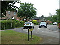
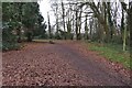
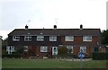
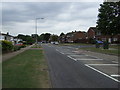
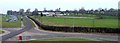
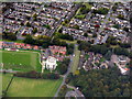
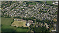
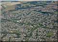
11 photos from this area
Area Information
Key information about the SG1 5PW including its size, population, and administrative classification.
- Area Type
- Postcode
- Area Size
- 6211 m²
- Population
- 1440
- Population Density
- 5500 people/km²
House Prices in SG1 5PW
18
Properties
£134,594
Average Sold Price
£65,000
Lowest Price
£279,000
Highest Price
Showing 18 properties
| Address | Type | Beds | Baths | Last Sale Price | Last Sale Date | |
|---|---|---|---|---|---|---|
| 69 Verity Way, Stevenage, SG1 5PW | house | - | - | £279,000 | Jul 2021 | |
| 59 Verity Way, Stevenage, SG1 5PW | Flat | 1 | 1 | £131,000 | May 2018 | |
| 85 Verity Way, Stevenage, SG1 5PW | Flat | - | - | £157,500 | May 2017 | |
| 83 Verity Way, Stevenage, SG1 5PW | Flat | - | - | £111,000 | Jul 2014 | |
| 67 Verity Way, Stevenage, SG1 5PW | house | 3 | - | £160,000 | Oct 2013 | |
| 61 Verity Way, Stevenage, SG1 5PW | Flat | - | - | £74,000 | Jan 2009 | |
| 79 Verity Way, Stevenage, SG1 5PW | Flat | - | - | £99,250 | Jul 2004 | |
| 71 Verity Way, Stevenage, SG1 5PW | Terraced | - | - | £65,000 | Oct 1997 | |
| 57 Verity Way, Stevenage, SG1 5PW | Flat | - | - | - | - | |
| 63 Verity Way, Stevenage, SG1 5PW | Flat | - | - | - | - |
Page 1 of 2
Energy Efficiency in SG1 5PW
Amenities
Schools
| Rank | School | Type | Entry gender | Ages |
|---|
Explore more schools in this area
Go to Schools tabDemographics
Household Size
One person
most common
Accommodation Type
Houses
most common
Tenure
57
majority
Ethnic Group
White
most common
Religion
N/A
most common
Household Composition
N/A
most common
Age
47
median
Adults (30-64 years)
most common
Household Deprivation
N/A
with no deprivation
NS-SEC
27
in Lower managerial occupations
Explore more demographic insights in this area
Go to Demographics tabPlanning
Planning Constraints
- Flood RiskPremium
- Ramsar Wetland SitesPremium
- Area of Outstanding Natural BeautyPremium
- Protected Nature ReservePremium
- Protected WoodlandPremium