Area Overview for SG1 5NE
Photos of SG1 5NE
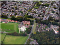
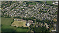
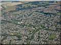
11 photos from this area
Area Information
Key information about the SG1 5NE including its size, population, and administrative classification.
- Area Type
- Postcode
- Area Size
- 5256 m²
- Population
- 1785
- Population Density
- 6430 people/km²
House Prices in SG1 5NE
10
Properties
£205,250
Average Sold Price
£58,500
Lowest Price
£355,000
Highest Price
Showing 10 properties
| Address | Type | Beds | Baths | Last Sale Price | Last Sale Date | |
|---|---|---|---|---|---|---|
| 406 Jessop Road, Stevenage, SG1 5NE | house | - | - | £355,000 | Sep 2022 | |
| 412 Jessop Road, Stevenage, SG1 5NE | Terraced | 3 | - | £335,000 | Jan 2020 | |
| 404 Jessop Road, Stevenage, SG1 5NE | house | - | - | £260,000 | Nov 2019 | |
| 410 Jessop Road, Stevenage, SG1 5NE | Terraced | - | - | £149,000 | Mar 2006 | |
| 398 Jessop Road, Stevenage, SG1 5NE | Semi-detached | - | - | £74,000 | Aug 1997 | |
| 402 Jessop Road, Stevenage, SG1 5NE | Terraced | 3 | - | £58,500 | Aug 1995 | |
| 408A Jessop Road, Stevenage, SG1 5NE | Maisonette | 2 | 1 | - | - | |
| 408 Jessop Road, Stevenage, SG1 5NE | Maisonette | 1 | 1 | - | - | |
| 400 Jessop Road, Stevenage, SG1 5NE | Terraced | - | - | - | - | |
| 396 Jessop Road, Stevenage, SG1 5NE | house | - | - | - | - |
Energy Efficiency in SG1 5NE
Amenities
Schools
| Rank | School | Type | Entry gender | Ages |
|---|
Explore more schools in this area
Go to Schools tabDemographics
Household Size
One person
most common
Accommodation Type
Houses
most common
Tenure
54
majority
Ethnic Group
White
most common
Religion
N/A
most common
Household Composition
N/A
most common
Age
47
median
Adults (30-64 years)
most common
Household Deprivation
N/A
with no deprivation
NS-SEC
30
in Lower managerial occupations
Explore more demographic insights in this area
Go to Demographics tabPlanning
Planning Constraints
- Flood RiskPremium
- Ramsar Wetland SitesPremium
- Area of Outstanding Natural BeautyPremium
- Protected Nature ReservePremium
- Protected WoodlandPremium