Area Overview for SG1 5HT
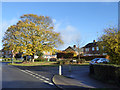
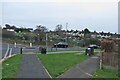
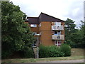
Photos of SG1 5HT


Area Information
Living in SG1 5HT means residing within a compact residential cluster where the population stands at 1,915 people. This specific postcode area offers a quiet domestic setting distinct from the broader Stevenage town centre. The streets are carved out for residents rather than throngs of commuters, creating a neighbourhood where daily life moves at a measured pace. You will find that the area functions as a self-contained home for those who value proximity to services without the noise of a high-density urban zone. The small size of the locality influences the pace of life significantly. Shops and transport links fall within practical reach, allowing you to manage daily errands without lengthy travel. The environment is defined by its residential nature, making it suitable for buyers seeking a lower-key address while remaining connected to the wider district. This cluster represents a niche segment of local housing where exclusivity comes in the form of space and access rather than price tags on luxury developments. Your home in SG1 5HT sits among neighbours who have called this specific spot home for a considerable time. The sense of community arises from the physical closeness of the houses rather than planned social events or town centre gatherings. This arrangement provides a stable backdrop for families or individuals looking to settle down. The area does not rely on flashy attractions but rather on the fundamental reliability of a quiet, established housing cluster. You gain a property in an environment where the focus remains on living rather than shopping or tourism.
- Area Type
- Postcode
- Area Size
- Not available
- Population
- 1915
- Population Density
- 3742 people/km²
The property market in SG1 5HT is characterised by a strong bias towards owned housing. With 45% of homes occupied by their owners, this area stands apart from rental-heavy districts where landlords dominate the portfolio. You will find that the stock is largely comprised of houses, which aligns with the needs of families and older owners seeking more space. This mix of houses and owner-occupiers suggests a stable market where price movements are often driven by local economic shifts rather than speculative investment cycles. Buyers looking at this small cluster should expect a limited but focused selection of properties. The prevalence of house ownership means that many current residents are unlikely to upsize or downsize quickly, reducing the annual turning of stock. This creates an environment where the right buyer often matches the existing homeowner's desire to stay put. The nature of the accommodation type further narrows the potential buyer pool to those who prefer overground living compared to flats or city centre apartments. For those entering the market here, the dynamic differs significantly from major urban centres. The 45% ownership rate indicates a community invested in its immediate surroundings. New purchases often serve existing families rather than students or digital nomads seeking short-term leases. Consequently, the local property values reflect the enduring appeal of house ownership in a quiet cluster. Prospective buyers must be prepared to wait for a suitable property to come to market, as the low turnover typical of owner-occupied areas ensures that competition drives up prices over time.
House Prices in SG1 5HT
No properties found in this postcode.
Energy Efficiency in SG1 5HT
Living in SG1 5HT offers easy access to essential retail and transport hubs without the congestion of the town centre. Nearby retail options include the Co-op Stevenage, which serves as a primary destination for daily groceries and household essentials. Morrisons Daily operates in the vicinity twice, providing convenient access to supermarket chains. This variety of five retail outlets ensures you are never far from food or shopping supplies. You can do your weekly shopping or pick up last-minute items with ease. Transport links are equally well-positioned for residents who rely on trains. Stevenage Railway Station, Knebworth Railway Station, and Hitchin Railway Station are all within practical reach. Having five rail options nearby means you have multiple departure points for your commute to London or other destinations. The proximity of Stevenage and Hitchin stations provides flexibility for travel plans, allowing you to choose the route that suits your schedule best. This blend of nearby shops and multiple train stations creates a lifestyle where you do not live on the fringe of the city. You remain close to amenities that the broader region offers. Whether you need a quick stop for provisions or a full trip to the fishing village at Knebworth, the distance remains manageable. The layout supports a self-sufficient daily routine where you make the most of your morning commute and your evening return trips.
Amenities
Schools
Residents of SG1 5HT have access to a specific set of educational institutions within their immediate vicinity. The local educational landscape is centred around special needs schools, which serve as the primary options for students in the area. Hilltop School stands as one of these providers, catering to children with special educational requirements. High Wick School operates alongside it, offering similar specialised support to local learners. Larwood School appears twice in the local vicinity records, confirming its presence as a significant special needs institution for the cluster. This concentration of special schools suggests that the area has historically served a specific demographic of students requiring tailored education rather than a mainstream broad catchment. While the national school system includes a variety of primary and secondary options, the schools listed near SG1 5HT focus on special educational needs. Family planners should note this distinction when considering what educational types are immediately on their doorstep. The absence of standard comprehensive or academy schools in the immediate list highlights the unique character of the local education provision. Parents residing here rely on these specialised establishments for their children's development. The presence of these institutions indicates a strong commitment to inclusive education within the broader Stevenage area. Families with children who benefit from special education thrive in this environment, while those seeking mainstream secondary options must look to neighbouring areas beyond the immediate postcode boundaries.
| Rank | School | Type | Entry gender | Ages |
|---|
Explore more schools in this area
Go to Schools tabDemographics
The community in SG1 5HT is defined by a mature resident base with a median age of 47 years. The most common age range comprises adults between 30 and 64 years old, indicating a household composition that prioritises stability and long-term settlement. Home ownership accounts for 45% of the population, which suggests a significant portion of residents have purchased their properties and plan to stay. The remaining homes are likely tenanted or awaiting sale, though the majority reflect a desire for permanent residence. Accommodation types in this area consist principally of houses, reinforcing the image of a family-oriented neighbourhood rather than a high-rise or flat complex zone. This housing style aligns with the preferences of older adults who often upgrade to detached or semi-detached properties as they move away from renting. The predominant ethnic group is White, reflecting the traditional demographic makeup of the Stevenage region. While the area remains diverse, the primary cultural influence stems from the established communities that built this section of the district. These figures indicate a neighbourhood where residents are less likely to be young deposit-hunters or transient students. Instead, the population consists of people who value security and established neighbourhoods. Home ownership levels show that nearly half the residents made the transition from tenants to owners. This statistic influences the local market, as existing owners often take longer to relocate, maintaining the area's character over time.
Household Size
Accommodation Type
Tenure
Ethnic Group
Religion
Household Composition
Age
Household Deprivation
NS-SEC
Explore more demographic insights in this area
Go to Demographics tabPlanning
Planning Constraints
- Flood RiskPremium
- Ramsar Wetland SitesPremium
- Area of Outstanding Natural BeautyPremium
- Protected Nature ReservePremium
- Protected WoodlandPremium