Area Overview for SG1 4DG
Photos of SG1 4DG

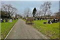
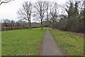
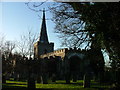
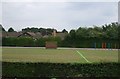
11 photos from this area
Area Information
Key information about the SG1 4DG including its size, population, and administrative classification.
- Area Type
- Postcode
- Area Size
- 5417 m²
- Population
- 1477
- Population Density
- 6573 people/km²
House Prices in SG1 4DG
18
Properties
£152,923
Average Sold Price
£49,000
Lowest Price
£325,000
Highest Price
Showing 18 properties
| Address | Type | Beds | Baths | Last Sale Price | Last Sale Date | |
|---|---|---|---|---|---|---|
| 26 Canterbury Way, Stevenage, SG1 4DG | Flat | - | - | £153,000 | Apr 2023 | |
| 18 Canterbury Way, Stevenage, SG1 4DG | Flat | - | - | £145,000 | Jun 2021 | |
| 4 Canterbury Way, Stevenage, SG1 4DG | house | - | - | £325,000 | Oct 2018 | |
| 34 Canterbury Way, Stevenage, SG1 4DG | Flat | - | - | £154,400 | Jun 2018 | |
| 2 Canterbury Way, Stevenage, SG1 4DG | Detached | 4 | 2 | £255,000 | May 2015 | |
| 10 Canterbury Way, Stevenage, SG1 4DG | Flat | - | - | £125,000 | Jan 2015 | |
| 22 Canterbury Way, Stevenage, SG1 4DG | Flat | - | - | £80,000 | Jan 2008 | |
| 20 Canterbury Way, Stevenage, SG1 4DG | Flat | 1 | 1 | £117,750 | May 2007 | |
| 8 Canterbury Way, Stevenage, SG1 4DG | Terraced | - | - | £163,000 | Nov 2005 | |
| 16 Canterbury Way, Stevenage, SG1 4DG | Maisonette | - | - | £115,000 | Jun 2004 |
Page 1 of 2
Energy Efficiency in SG1 4DG
Amenities
Schools
| Rank | School | Type | Entry gender | Ages |
|---|
Explore more schools in this area
Go to Schools tabDemographics
Household Size
Family (3-5 people)
most common
Accommodation Type
Houses
most common
Tenure
66
majority
Ethnic Group
White
most common
Religion
N/A
most common
Household Composition
N/A
most common
Age
47
median
Adults (30-64 years)
most common
Household Deprivation
N/A
with no deprivation
NS-SEC
31
in Lower managerial occupations
Explore more demographic insights in this area
Go to Demographics tabPlanning
Planning Constraints
- Flood RiskPremium
- Ramsar Wetland SitesPremium
- Area of Outstanding Natural BeautyPremium
- Protected Nature ReservePremium
- Protected WoodlandPremium