Area Overview for SG1 3RY
Photos of SG1 3RY


Area Information
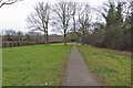
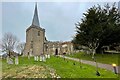
Living in SG1 3RY means residing within a small, defined residential cluster comprising just 2.6 hectares. This compact footprint creates a tight-knit environment where the 1,819 residents interact within close proximity. The area sits firmly on the outskirts of Stevenage, offering a quiet retreat without being completely isolated from urban conveniences. While the high population density of 68,860 people per square kilometre might initially seem surprising for such a small zone, it reflects the intensity of the housing clusters in this specific postcode sector. You will find this postcode serves as a settled residential hub rather than a commercial or industrial zone. The local character is shaped by mature housing estates that cater to families and established households. Daily life here involves a balance of suburban tranquility and access to the wider transport network of the East of England. The area does not boast vast green spaces within its immediate boundaries, yet it benefits from clear safety assessments regarding flood risks and environmental constraints. Prospective buyers viewing SG1 3RY will notice an environment focused on stability and ownership. The demographics suggest a community that has put down roots, with a significant majority owning their homes. This is not a transient area but a place where long-term residents dominate the landscape. If you are seeking a specific postcode for a move, SG1 3RY offers a distinct slice of Stevenage's housing stock that prioritises density and established neighbourhood ties over expansive new developments.
- Area Type
- Postcode
- Area Size
- 2.6 hectares
- Population
- 1819
- Population Density
- 2791 people/km²
The housing market in SG1 3RY is heavily skewed towards ownership. With 73% of residents owning their homes, the area reflects a mature market where families have settled for the long term. The predominant accommodation type is houses, meaning you will find very few detached or semi-detached homes, with flats being rare in this specific sector. This composition creates a distinct buying landscape compared to nearby urban centres or student-heavy zones. When you search for homes in SG1 3RY, expect to encounter properties designed for family living rather than investment rentals or first-time buyer starter units. The high ownership rate implies that many current owners may choose to stay or upgrade rather than sell, potentially limiting immediate stock availability. However, for those looking, the area offers stability rather than the volatility of new-build developments. This postcode does not cater to a millennial rental market or the young professionals often found in city centres. Instead, the market serves households seeking permanence. If you are looking at bigger plots or extended family homes, this area aligns with those needs due to the prevalence of houses. The small area size of 2.6 hectares means the choice of specific addresses is limited, requiring careful selection of the right street. Buyers should approach SG1 3RY as a serious residential cluster rather than a speculative investment opportunity.
House Prices in SG1 3RY
Showing 41 properties
| Address | Type | Beds | Baths | Last Sale Price | Last Sale Date | |
|---|---|---|---|---|---|---|
| 6 Trafford Close, Stevenage, SG1 3RY | Semi-detached | - | - | £276,646 | May 2025 | |
| 30 Trafford Close, Stevenage, SG1 3RY | Semi-detached | 4 | 2 | £520,000 | Mar 2025 | |
| 39 Trafford Close, Stevenage, SG1 3RY | Detached | 4 | 2 | £578,500 | Apr 2023 | |
| 24 Trafford Close, Stevenage, SG1 3RY | house | - | - | £745,000 | Apr 2023 | |
| 1 Trafford Close, Stevenage, SG1 3RY | house | 4 | 2 | £770,000 | Aug 2022 | |
| 29 Trafford Close, Stevenage, SG1 3RY | Semi-detached | 3 | 2 | £425,000 | Jun 2021 | |
| 13 Trafford Close, Stevenage, SG1 3RY | house | - | - | £325,000 | Aug 2020 | |
| 7 Trafford Close, Stevenage, SG1 3RY | Semi-detached | 4 | 1 | £450,000 | Aug 2019 | |
| 27 Trafford Close, Stevenage, SG1 3RY | house | - | - | £450,000 | Jul 2019 | |
| 40 Trafford Close, Stevenage, SG1 3RY | Detached | 4 | 1 | £500,000 | Aug 2017 |
Energy Efficiency in SG1 3RY
Living in SG1 3RY offers straightforward access to essential amenities with minimal travel time. For daily shopping needs, you have five notable retail options nearby. Morrisons Daily and Co-op Stevenage are specific venues you can rely on for groceries and household essentials. These shops keep your routine efficient without requiring long trips into busy city centres. Transport needs are covered by five nearby railway stations, including Stevenage, Knebworth, and Hitchin. This rail accessibility strengthens the lifestyle appeal of the postcode by connecting you to wider opportunities. While specific parks or leisure centres are not detailed in the current data, the proximity of major supermarkets and train stations forms the backbone of your routine. The area supports a practical, efficient lifestyle focused on convenience. You do not need to commute far for your weekly shop or daily coffee run. The presence of multiple Morrisons Daily locations suggests competition and variety in pricing and stock, benefiting the local resident. For families, the combination of local retail and excellent rail links reduces the burden of travel time, allowing more focus on home life and the community.
Amenities
Schools
Education options near SG1 3RY include a range of secondary and primary institutions catering to different family needs. For younger children, Letchmore Infants' and Nursery School offers primary education with an outstanding Ofsted rating. This high standard is rare and valuable for parents prioritising early childhood learning. alternative primary choices include Almond Hill Junior School, which holds a good Ofsted rating, and Barclay School and The Thomas Alleyne School, which provide additional primary education though specific Ofsted grades are not listed for these two in the current data. Once children reach the academy stage, The Thomas Alleyne Academy provides secondary education. This institution currently holds a good Ofsted rating, ensuring a standard level of academic oversight. For families relying heavily on state-provided education, this mix of outstanding, good, and ungraded schools provides a solid, albeit varied, selection. The presence of both primary and secondary options within practical reach is a key feature of living in SG1 3RY. You have the option to choose between schools with proven track records of excellence and those that meet the standard government requirements. While you cannot name a specific secondary academy with an outstanding rating in your immediate data, the inclusion of The Thomas Alleyne Academy ensures local families do not need to commute far for their children's core schooling requirements. This cluster of schools supports the demographic of adults aged 30-64 who form the bulk of the local population.
| Rank | School | Type | Entry gender | Ages |
|---|
Explore more schools in this area
Go to Schools tabDemographics
The community in SG1 3RY is defined by stability and maturity. The average resident is 47 years old, placing this area well past typical retirement age yet still firmly in the middle adult bracket. Most households consist of adults aged between 30 and 64, indicating a population that balances career focus with family raising. This age profile suggests schools remain nearly essential for the district, while leisure pursuits likely centre on family activities and community governance. Home ownership stands at 73%, which is a significant figure for any UK location. This high rate points to a neighbourhood where people have historically invested in property rather than renting. You will encounter predominantly detached or semi-detached houses, as flats are not a common feature of the housing stock in this specific postcode. The demographic makeup remains overwhelmingly White, reflecting the traditional settlement patterns of this part of Stevenage. These statistics paint a picture of a settled, owner-occupied community. The lack of a large student population or high transient rental sector means local services face less fluctuation in usage. For someone considering purchasing here, the data suggests a quiet, reliable environment where neighbours know one another and property values have likely appreciated steadily over time. The concentration of adults in their prime earning years also makes this an area where local businesses can rely on a consistent customer base for goods and services.
Household Size
Accommodation Type
Tenure
Ethnic Group
Religion
Household Composition
Age
Household Deprivation
NS-SEC
Explore more demographic insights in this area
Go to Demographics tabPlanning
Planning Constraints
- Flood RiskPremium
- Ramsar Wetland SitesPremium
- Area of Outstanding Natural BeautyPremium
- Protected Nature ReservePremium
- Protected WoodlandPremium