Area Overview for SG1 3NW
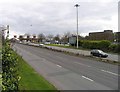
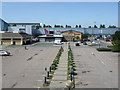
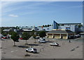
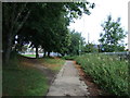
Photos of SG1 3NW


Area Information
SG1 3NW is a specific postcode area covering a small residential cluster within England. This location houses a population of 2,302 residents, creating a tight-knit community rather than a sprawling suburb. Living in SG1 3NW means operating within a defined pocket of housing where your neighbours are close by and daily routines are shaped by local footpaths rather than extensive ring roads. The area represents a distinct slice of Stevenage, characterised by its density and specific infrastructural layout. Daily life here revolves around a settled population. The area attracts people who value proximity to established services and know exactly who lives on their street. Because this is a small postcode cluster, you will experience a high degree of familiarity with your immediate surroundings. There are no major commercial distractions within the postcode itself, which fosters a quieter domestic environment. The focus is strictly on residential living, with minimal industrial interference. For those considering homes in SG1 3NW, the setting is straightforward. You are looking at a mature settlement where the character is defined by its boundaries and its integration into the wider town structure. This area does not offer the anonymity of a large new development, nor the isolation of the countryside. Instead, you find a functional residential zone that serves the immediate needs of its 2,302 occupants. It is a place where the local identity is well-formed, and where life moves at a pace dictated by a small, stable community.
- Area Type
- Postcode
- Area Size
- Not available
- Population
- 2302
- Population Density
- 4934 people/km²
Homes in SG1 3NW are characterised by a specific type of accommodation found across the country. Flats represent the predominant accommodation type in this postcode. This reality dictates the floor plans you will encounter and the utility of the space available. Buyers should expect a market driven by vertical living rather than single-story detached homes. The stock is likely composed of first-floor and second-floor units within larger buildings or converted structures. With a home ownership rate of 42%, the area presents a mixed market. You will encounter motivated sellers looking to downsize or move up, alongside landlords seeking steady tenancies. The lower ownership figure compared to the national average suggests a higher proportion of private renters. This dynamic affects the stability of the community and the resale values of properties. If you are buying a flat here, you should verify lease terms and service charges alongside the purchase price. The small size of this cluster means supply remains limited. Competition for desirable flats in SG1 3NW can be fierce when a listing appears. The market is practical, driven by location and accessibility rather than speculative development plots. Prospective buyers should act quickly when viewing homes in this area, as the number of available properties suitable for families is naturally constrained by the flat-dominant estate layout.
House Prices in SG1 3NW
No properties found in this postcode.
Energy Efficiency in SG1 3NW
The lifestyle in SG1 3NW is defined by the immediate availability of major retail chains and transport hubs. You have supermarkets like Asda Lytton, Aldi Stevenage, and Morrisons Daily within practical reach. These large retailers ensure you can stock up on groceries and household essentials without needing to travel far. The presence of five retail options within the wider vicinity provides ample choice for shoppers. Transport infrastructure is also a cornerstone of the local experience. Five railway stations serve the area, including Stevenage Railway Station, Knebworth Railway Station, and Hitchin Railway Station. Access to these nodes means you can commute into London or other regions easily. The combination of self-service and discount supermarkets with reliable rail connections creates a convenient daily routine. Residents do not need to rely on a personal car for every trip. Leisure options described in the available data focus on these retail and transport strengths. While specific pubs, parks, or cinemas are not listed in the immediate amenity data, the retail provision supports a self-sufficient lifestyle. Dining options are likely associated with the larger supermarkets or nearby public houses linked to the railway stations. Living in SG1 3NW offers the advantage of efficiency. You return home from Asda or the station and are still in your local residential cluster, maintaining a simple and predictable day.
Amenities
Schools
Families living in SG1 3NW have access to two specific primary institutions within their catchment vicinity. Fairlands Primary School and Nursery operates as a primary school, offering education for younger children alongside childcare provision. Fairlands Primary School also serves the same educational function, likely differing in catering to older age bands or acting as a specialist feeder. Both schools are primary institutions, indicating that families with infants will remain in the area for the early years of education. This concentration of primary schools suggests that the area is targeted at families with young children rather than teenagers requiring secondary education. If you are buying in SG1 3NW, you must consider the gap between primary education and secondary school options. The presence of nurseries at Fairlands Primary School and Nursery adds convenience for working parents who require simultaneous childcare for their infants during term time. The choice between these two primary schools allows some flexibility for local families in terms of admission policies or proximity to specific streets. Living in SG1 3NW grants you immediate access to these facilities, reducing travel time for school runs. However, the lack of named secondary schools in the data means you must look outside the immediate postcode for older pupils. School inspections and Ofsted ratings are crucial factors to research before finalising a property purchase in this specific locale.
| Rank | School | Type | Entry gender | Ages |
|---|
Explore more schools in this area
Go to Schools tabDemographics
The community in SG1 3NW is predominantly composed of adults aged between 30 and 64 years. This age profile defines the social dynamics of the neighbourhood, with a median age of 47 years. You will find that the majority of residents fall into this bracket, suggesting a family-oriented or early retirement demographic rather than a student-heavy zone. The lack of young children or elderly-dominated statistics points towards households with established careers and stable family units. Home ownership stands at 42%, meaning nearly half of the residents own their dwellings outright or with a mortgage. The remaining households likely reside in rental properties. This ownership rate indicates a mid-range market where investment is common but not universal. The dominance of flats as the primary accommodation type shapes how people live. Living in SG1 3NW often involves multi-unit buildings or converted structures rather than detached houses, influencing noise separation and budget requirements. The predominant ethnic group is White, mirroring the broader demographic trends of many parts of the UK. The population is relatively homogeneous in its ethnic composition. With 2,302 total residents, the social fabric is tight, and community events likely reflect these multicultural characteristics without extreme fragmentation. The data paints a clear picture of a settled adult population living in flat-based accommodation with a mix of owners and renters.
Household Size
Accommodation Type
Tenure
Ethnic Group
Religion
Household Composition
Age
Household Deprivation
NS-SEC
Explore more demographic insights in this area
Go to Demographics tabPlanning
Planning Constraints
- Flood RiskPremium
- Ramsar Wetland SitesPremium
- Area of Outstanding Natural BeautyPremium
- Protected Nature ReservePremium
- Protected WoodlandPremium