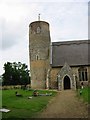
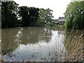
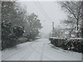
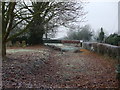
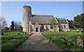
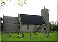
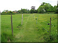
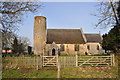
Area Overview for Seething
Photos of Seething


Area Information
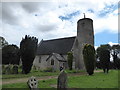
Seething is a compact built-up area in England, spanning 30.5 hectares. It is a place where older residents predominate, with a median age of 70, reflecting a community that values stability and familiarity. The area is not large, but its proximity to amenities and transport links makes it practical for daily life. Seething’s character is defined by its quieter rhythm, with a focus on local services and connections. Residents benefit from nearby schools, rail access, and retail options, creating a self-contained environment. While the population is older, the area remains functional, with a home ownership rate of 75% suggesting long-term residency. Living in Seething means prioritising convenience over urban vibrancy, with a strong emphasis on accessible essentials. The area’s compact size means everything is within walking or short driving distance, making it ideal for those seeking a low-maintenance lifestyle.
- Area Type
- Built Up Area 250
- Area Size
- 30.5 hectares
- Population
- Not available
- Population Density
- Not available
Residents of Seething have access to a range of nearby amenities. Three retail outlets—Co-op Loddon, Morrisons Daily, and Co-op Bungay—provide essential shopping. Two railway stations, Buckenham and Cantley, offer connections to regional hubs, while the Reedham Ferry North facilitates local travel. Though the area is small, these amenities create a functional lifestyle, reducing the need for long commutes. The presence of a primary school and retail options suggests a community-oriented approach to daily life. Parks or leisure facilities are not specified, but the proximity to transport and shops implies a balance between convenience and quiet living. For those valuing self-sufficiency, Seething’s amenities are sufficient for routine needs.
Amenities
Schools
The primary school serving Seething is Seething and Mundham Primary School, which has an Ofsted rating of ‘good’. This school is the only educational institution explicitly listed for the area, indicating a focus on primary education. The absence of secondary schools or further education providers suggests families may need to look beyond Seething for comprehensive schooling. The ‘good’ rating reflects adequate standards, but parents should consider the broader educational landscape when planning for children’s long-term needs. For those prioritising proximity to schools, Seething offers a reliable primary option, though secondary education would require commuting.
| Rank | A + A* % | School | Type | Entry gender | Ages |
|---|---|---|---|---|---|
| 1 | N/A | Seething and Mundham Primary School | primary | N/A | N/A |
| 2 | N/A | Seething and Mundham Primary School | primary | N/A | N/A |
Explore more schools in this area
Go to Schools tabDemographics
Seething’s population has a median age of 70, with the most common age range encompassing all age groups. This suggests a community skewed towards older residents, which influences the area’s pace of life and social dynamics. Home ownership is high at 75%, indicating a stable, long-term resident base. The data does not specify household composition or accommodation types, but the overall profile points to a mature demographic with fewer young families. The area’s diversity metrics are not detailed, but the absence of specific ethnic or religious breakdowns implies a homogenous population. This demographic structure may affect local services and amenities, which cater more to older adults than to children or young professionals. The lack of detailed deprivation data means quality of life factors such as access to healthcare or leisure are not quantified here.
Household Size
Accommodation Type
Tenure
Ethnic Group
Religion
Household Composition
Age
Household Deprivation
NS-SEC
Explore more demographic insights in this area
Go to Demographics tabPlanning
Planning Constraints
- Crime RiskLocked